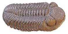
Phacops Rana
Friday, August 5, 2011
Tropical Storm Emily is a wash
Of all the possible outcomes, Tropical Storm Emily blew itself out as it passed over the Dominican Republic. Today (Friday, Aug. 5) what was Emily was a large area of disturbed weather north of the Dominican Republic. Meteorologists are watching that area. It could still redevelop into a tropical storm.

Thursday, August 4, 2011
Tropical Storm Emily will move north
Tropical Storm Emily has been dropping drenching rain over the Dominican Republic and Haiti today (August 4). The storm grew out of a disturbance over the central tropical Atlantic. Movement is to the west-northwest at five miles per hour with winds at 50 MPH and a central pressure of 1004 milibars, or 29.65 inches of mercury.
The storm is expected to move to a northwest track, then curve more northward in coming days. This track will take the storm between eastern Cuba and the Dominican Republic, then skirt the western Bahamas, brush against the east coast of Florida in the vicinity of Miami on Saturday, then move northward before curving again to the northeast early next week.
This track could also take the storm over the Outer Banks, or over Bermuda.
The storm is expected to move to a northwest track, then curve more northward in coming days. This track will take the storm between eastern Cuba and the Dominican Republic, then skirt the western Bahamas, brush against the east coast of Florida in the vicinity of Miami on Saturday, then move northward before curving again to the northeast early next week.
This track could also take the storm over the Outer Banks, or over Bermuda.
Tuesday, August 2, 2011
No sense rushing autumn
[Adventures on Earth for the August 3, 2011, edition of The Review]
These are the lazy, hazy days of summer, also known as the dog days, also known as the time of estivation.
Estivation is a state of torpor in animals, laziness brought on by the heat of summer days.
Animals, during summer, are at their busiest in the cool of morning or in the evening when the sun is going down. The height of the day when temperatures soar is when wild creatures stretch out and doze.
We humans, being animals, would also like to doze away the hottest hours of the day. Our workaday world, though, frowns on that.
So we labor the day away and are tired at night.
The height of summer does not last long. By mid-August a cold front comes through, dropping temperatures for a short while. It warms back up, but that cold front presages arrival of autumn.
Autumn arrives, of course, on Sept. 23, the autumnal equinox. That is when the hours of daylight and darkness are about equal.
In the natural world, autumn arrives in late August to early September. Mother Nature is not picky over dates. Autumn arrives when she says it does, and she is fickle about such things.
It is weather, as well as hours of sunlight, that determine the seasons in the natural world.
By late August and early September, the deep green of summer begins to soften. The progression of native flowers slows down. Very little will bloom from that point on.
Estivation gives way to a frantic preparation for winter. Some creatures store food. Squirrels will bury acorns and other nuts. They forget where they bury it all, but they bury plenty and can generally find enough to last the winter.
Other creatures increase their food intake, transforming calories and protein into fat reserves that will see them through winter.
On the farm, harvest time begins in August. It is the time to get hay into the barn, grains into granaries, and sileage into the silos. The harvest will feed livestock through the winter.
Food for humans has been frozen or canned. By the time the cold snap arrives, most of the work will be done.
The tropical season reaches its peak in a couple of weeks. Already tropical storms have been in the news. More will come as the Cape Verde season heats up.
The tropical Atlantic is now at its warmest, with surface temperatures above 80 degrees Fahrenheit. That is prime conditions for storm development.
Tropical season lasts until the end of November, but begins to slow down about mid-September. For a month the threat of major storms is at its highest. On any given day there may be two or three storms churning in the Atlantic or the Gulf.
Weather patterns take about a week to ten days to pass at this time of year. By mid-September fronts will pass more regularly and weather will change on a moment’s whim.
By the equinox, the one constant about our weather will be change. From day to day it will go from cold to warm to cool to hot. It may rain or not. It may change within 24 hours.
People who now gripe about the heat will gripe because of the fickle weather. Wise people take a jacket and umbrella to work regardless of the forecast.
In the meantime, we have a few weeks of hot weather. It is, after all, the time of estivation. There is no sense rushing autumn.
These are the lazy, hazy days of summer, also known as the dog days, also known as the time of estivation.
Estivation is a state of torpor in animals, laziness brought on by the heat of summer days.
Animals, during summer, are at their busiest in the cool of morning or in the evening when the sun is going down. The height of the day when temperatures soar is when wild creatures stretch out and doze.
We humans, being animals, would also like to doze away the hottest hours of the day. Our workaday world, though, frowns on that.
So we labor the day away and are tired at night.
The height of summer does not last long. By mid-August a cold front comes through, dropping temperatures for a short while. It warms back up, but that cold front presages arrival of autumn.
Autumn arrives, of course, on Sept. 23, the autumnal equinox. That is when the hours of daylight and darkness are about equal.
In the natural world, autumn arrives in late August to early September. Mother Nature is not picky over dates. Autumn arrives when she says it does, and she is fickle about such things.
It is weather, as well as hours of sunlight, that determine the seasons in the natural world.
By late August and early September, the deep green of summer begins to soften. The progression of native flowers slows down. Very little will bloom from that point on.
Estivation gives way to a frantic preparation for winter. Some creatures store food. Squirrels will bury acorns and other nuts. They forget where they bury it all, but they bury plenty and can generally find enough to last the winter.
Other creatures increase their food intake, transforming calories and protein into fat reserves that will see them through winter.
On the farm, harvest time begins in August. It is the time to get hay into the barn, grains into granaries, and sileage into the silos. The harvest will feed livestock through the winter.
Food for humans has been frozen or canned. By the time the cold snap arrives, most of the work will be done.
The tropical season reaches its peak in a couple of weeks. Already tropical storms have been in the news. More will come as the Cape Verde season heats up.
The tropical Atlantic is now at its warmest, with surface temperatures above 80 degrees Fahrenheit. That is prime conditions for storm development.
Tropical season lasts until the end of November, but begins to slow down about mid-September. For a month the threat of major storms is at its highest. On any given day there may be two or three storms churning in the Atlantic or the Gulf.
Weather patterns take about a week to ten days to pass at this time of year. By mid-September fronts will pass more regularly and weather will change on a moment’s whim.
By the equinox, the one constant about our weather will be change. From day to day it will go from cold to warm to cool to hot. It may rain or not. It may change within 24 hours.
People who now gripe about the heat will gripe because of the fickle weather. Wise people take a jacket and umbrella to work regardless of the forecast.
In the meantime, we have a few weeks of hot weather. It is, after all, the time of estivation. There is no sense rushing autumn.
Thursday, July 28, 2011
Tropical Storm Don in the Gulf
The tropical depression in the Gulf of Mexico has grown, as expected into the fourth tropical storm of the Atlantic season: Don. At 2 p.m. Thursday, Don was in the central Gulf of Mexico on a northwesterly track at 14 miles per hour. Sustained winds were at 45 miles per hour with central pressure at 1005 milibars. The track the storm is following will likely take it to landfall along the central Texas coast. Further strengthening is likely over the warm Gulf waters.
Wednesday, July 27, 2011
Storm in the Gulf
A new storm formed south of Cuba early Tuesday and is moving into the Gulf of Mexico. Still a tropical depression, the storm was located between the western tip of Cuba and the Yucatan Peninsula at mid-day Wednesday moving west-northwest. Winds were 30 miles per hour with central pressure at 1008 milibars. The storm is expected to impact the coast of Texas by the weekend. Sea surface temperatures in the Gulf of Mexico are favorable for storm development.
The high point
Adventures on Earth for the July 27, 2011, edition of The Review
The Allegheny Plateau rises above the Ridge and Valley geological province to its east and south. It is the land that was only gently folded during the collision of what is now North America with Gondwanaland (Africa and South America) during the Allegheny Orogeny approximately 300 million years ago.
In the Ridge and Valley province, rock layers were sharply folded and stacked one against another.
This zone of compression ended at the Allegheny Front, which forms the eastern and southern boundary of the plateau.
Behind the front, in the gently sloping terrain, ridges of resistant rock rise above the floor of the plateau. Here and there, knobs rise above the ridgeline.
One such knob is the highest point in Pennsylvania. Mount Davis rises to 3,213 feet above sea level. It is on the ridge of Negro Mountain, which rises in Maryland and runs well into Pennsylvania.
Negro Mountain was named for a legendary African American who is supposed to have died valiantly fighting Native Americans when he and the party of white settlers was attacked.
Mount Davis is named for John Nelson Davis, a resident of the area, Civil War veteran, surveyor, and naturalist.
Mount Davis is not as spectacular as some high peaks in the United States. It stands not much above the ridgeline.
And the view from the observation tower, a rickety old steel fire observation tower converted to tourist use, is not spectacular.
To the east, Allegheny Mountain stands out and to the west, Laurel Mountain stands out. Between Negro Mountain and these two mountains are a few hills and a lot of the plateau.
To the south the view stretches into Maryland and West Virginia. To the north the view takes in the Allegheny Front and plateau.
Mount Davis is included in Forbes State Forest and is set aside as a nature preserve. Its high elevation means flora and some fauna would be unique to high elevation regions.
The rock that creates Negro Mountain is a hard, resistant sandstone of the Pottsville Group. The Pottsville group includes coal measures as well as layers of sandstone.
On the plateau the sandstone is found as cap rock, or the surface rock of a ridge.
Being harder and more resistant to erosion, it stands higher than the softer rock that is more easily eroded around it.
Faults, or cracks in the rock, allowed for erosion to the east and west.
You won’t find huge crowds on Mount Davis. It is not easy to reach because of the welter of roads in the area, but you can drive nearly to the top. From a parking lot, a gated road leads a short distance up toward the summit, then circles around it. The observation tower stands just off this road.
Just below the summit a display of plaques set into sandstone rocks offers a glimpse into much of the human and natural history of the area.
There is a large picnic area along the highway that crosses Negro Mountain and there are hiking trails through the area.
More information about Forbes State Forest can be found at http://www.dcnr.state.pa.us/forestry/stateforests/forbes/index.htm.
A map of hiking trails at Mount Davis can be found at http://www.dcnr.state.pa.us/ucmprd1/groups/public/documents/document/dcnr_002573.pdf
The Allegheny Plateau rises above the Ridge and Valley geological province to its east and south. It is the land that was only gently folded during the collision of what is now North America with Gondwanaland (Africa and South America) during the Allegheny Orogeny approximately 300 million years ago.
In the Ridge and Valley province, rock layers were sharply folded and stacked one against another.
This zone of compression ended at the Allegheny Front, which forms the eastern and southern boundary of the plateau.
Behind the front, in the gently sloping terrain, ridges of resistant rock rise above the floor of the plateau. Here and there, knobs rise above the ridgeline.
One such knob is the highest point in Pennsylvania. Mount Davis rises to 3,213 feet above sea level. It is on the ridge of Negro Mountain, which rises in Maryland and runs well into Pennsylvania.
Negro Mountain was named for a legendary African American who is supposed to have died valiantly fighting Native Americans when he and the party of white settlers was attacked.
Mount Davis is named for John Nelson Davis, a resident of the area, Civil War veteran, surveyor, and naturalist.
Mount Davis is not as spectacular as some high peaks in the United States. It stands not much above the ridgeline.
And the view from the observation tower, a rickety old steel fire observation tower converted to tourist use, is not spectacular.
To the east, Allegheny Mountain stands out and to the west, Laurel Mountain stands out. Between Negro Mountain and these two mountains are a few hills and a lot of the plateau.
To the south the view stretches into Maryland and West Virginia. To the north the view takes in the Allegheny Front and plateau.
Mount Davis is included in Forbes State Forest and is set aside as a nature preserve. Its high elevation means flora and some fauna would be unique to high elevation regions.
The rock that creates Negro Mountain is a hard, resistant sandstone of the Pottsville Group. The Pottsville group includes coal measures as well as layers of sandstone.
On the plateau the sandstone is found as cap rock, or the surface rock of a ridge.
Being harder and more resistant to erosion, it stands higher than the softer rock that is more easily eroded around it.
Faults, or cracks in the rock, allowed for erosion to the east and west.
You won’t find huge crowds on Mount Davis. It is not easy to reach because of the welter of roads in the area, but you can drive nearly to the top. From a parking lot, a gated road leads a short distance up toward the summit, then circles around it. The observation tower stands just off this road.
Just below the summit a display of plaques set into sandstone rocks offers a glimpse into much of the human and natural history of the area.
There is a large picnic area along the highway that crosses Negro Mountain and there are hiking trails through the area.
More information about Forbes State Forest can be found at http://www.dcnr.state.pa.us/forestry/stateforests/forbes/index.htm.
A map of hiking trails at Mount Davis can be found at http://www.dcnr.state.pa.us/ucmprd1/groups/public/documents/document/dcnr_002573.pdf
Wednesday, July 20, 2011
A convergence of conditions
Adventures on Earth for the July 20, 2011, edition of The Review\
By George E. Beetham Jr.
Tropical storm season 2011 got off to a slow start as it normally does. Bret, just the second Atlantic tropical storm of the year, was making its way across the Bahamas on Monday, heading on a track that would take it out to sea.
While Bret appeared to be no threat to the mainland, the season is proceeding apace and will pick up as we move into August.
By mid-August we will move into the heaviest part of tropical season.
Going forward, Atlantic storms will form in the Eastern Atlantic near the Cape Verde Islands off the west coast of Africa – the area known as the inter-tropical convergence zone.
As storms and disturbances move off the African coast they move out over warmer water, drawing heat and moisture from the ocean. The heat and moisture rise as convection currents, building huge clouds.
Unless something happens to disturb these storms, the convection builds into the counter-clockwise spin of tropical storms.
Pressure drops and the storm builds in wind speed as the pressure drops.
Cape Verde storms generally move westward across the Atlantic and over the Windward and Leeward Islands.
They can turn to the northwest or west into the Caribbean Ocean.
They can enter the Gulf of Mexico or spin up along the East Coast of the United States. In either case, they threaten the United States.
Not all Cape Verde storms intensify into serious hurricanes, but some do. When they do, it is wise if we monitor the progress of storms as they approach.
A storm entering the Gulf of Mexico can still turn northeastward and cross the Appalachian Mountains as a heavy rain storm, causing widespread flooding and landslides.
East Coast storms present dual threats. In addition to torrential rains, high winds, possible tornadoes, and storm surge are threats, particularly along the coast.
As tropical storms move over land they are cut off from the essentials they need: warm ocean water.
Without the warm moisture, the convection shuts down. Winds die down, but can still be a threat. At that point the main threat is heavy rains.
It is a good idea at this time of year to go to the National Oceanographic and Atmospheric Administration’s National Hurricane Center website. Bookmark the page for future reference.
There you will find tons of information about hurricanes and what you should do to prepare for them.
You can also find a list of tropical storm names through 2016, hurricane tracking charts, and more. The site includes advisories for active storms and an archive of storms that have passed.
Tropical storm activity increased in the late 1990s. Some meteorologists say the increase is a normal surge in a long lasting cycle. Others suspect global warming may be making storms more powerful.
It is a reality that surface temperatures in our oceans are rising. The increased temperatures make storm formation more likely, and as storms progress over warmer water they increase in intensity.
We are both at a high point in the natural cycle and at a point where sea surface temperatures or elevated.
It’s a convergence of conditions.
By George E. Beetham Jr.
Tropical storm season 2011 got off to a slow start as it normally does. Bret, just the second Atlantic tropical storm of the year, was making its way across the Bahamas on Monday, heading on a track that would take it out to sea.
While Bret appeared to be no threat to the mainland, the season is proceeding apace and will pick up as we move into August.
By mid-August we will move into the heaviest part of tropical season.
Going forward, Atlantic storms will form in the Eastern Atlantic near the Cape Verde Islands off the west coast of Africa – the area known as the inter-tropical convergence zone.
As storms and disturbances move off the African coast they move out over warmer water, drawing heat and moisture from the ocean. The heat and moisture rise as convection currents, building huge clouds.
Unless something happens to disturb these storms, the convection builds into the counter-clockwise spin of tropical storms.
Pressure drops and the storm builds in wind speed as the pressure drops.
Cape Verde storms generally move westward across the Atlantic and over the Windward and Leeward Islands.
They can turn to the northwest or west into the Caribbean Ocean.
They can enter the Gulf of Mexico or spin up along the East Coast of the United States. In either case, they threaten the United States.
Not all Cape Verde storms intensify into serious hurricanes, but some do. When they do, it is wise if we monitor the progress of storms as they approach.
A storm entering the Gulf of Mexico can still turn northeastward and cross the Appalachian Mountains as a heavy rain storm, causing widespread flooding and landslides.
East Coast storms present dual threats. In addition to torrential rains, high winds, possible tornadoes, and storm surge are threats, particularly along the coast.
As tropical storms move over land they are cut off from the essentials they need: warm ocean water.
Without the warm moisture, the convection shuts down. Winds die down, but can still be a threat. At that point the main threat is heavy rains.
It is a good idea at this time of year to go to the National Oceanographic and Atmospheric Administration’s National Hurricane Center website. Bookmark the page for future reference.
There you will find tons of information about hurricanes and what you should do to prepare for them.
You can also find a list of tropical storm names through 2016, hurricane tracking charts, and more. The site includes advisories for active storms and an archive of storms that have passed.
Tropical storm activity increased in the late 1990s. Some meteorologists say the increase is a normal surge in a long lasting cycle. Others suspect global warming may be making storms more powerful.
It is a reality that surface temperatures in our oceans are rising. The increased temperatures make storm formation more likely, and as storms progress over warmer water they increase in intensity.
We are both at a high point in the natural cycle and at a point where sea surface temperatures or elevated.
It’s a convergence of conditions.
Wednesday, February 2, 2011
An uncertain future
Adventures on Earth for February 2 edition of The Review
By George E. Beetham Jr.
It is the polar regions that have moderated Earth’s climate for many hundreds of thousands of years. A succession of ice ages has come and gone as temperatures fluctuated over millennia.
We are currently in a warming period, still recovering from the end of the last ice age some 10,000 years ago.
The scars of that glaciation are still with us – glacial lakes gouged from bedrock, deposits of till, and scars on bedrock where glaciers scoured away earth and rock.
Further, the land in many places continues to rise as it rebounds from the heavy load of ice.
The warming that is taking place is normal. What is not normal is the rapidity with which it is happening.
Almost every year the sea ice in the Arctic Ocean dwindles more and more. Glaciers are shrinking, permafrost is melting, and worldwide weather is subject to storms that seem to grow in severity.
There is concern that ocean levels will rise, ocean currents might shut down, and lands that currently support agriculture could turn to desert.
These are not the rants of alarmists, but the cautions of scientists who have studied Earth’s history of warming and cooling.
What is cause for concern is that the current warming trend is happening a lot faster than anybody previously thought.
We are not yet certain of what triggers changes in weather cycles. Some suggest that Earth’s orbit may change, taking it farther from the sun every so many thousands of years. At any rate, the changes do occur.
Ice ages come and ice ages go. With the coming and going of ice, the effects of climate are felt in the life that makes its home here on Earth.
That includes us. The last ice age caused profound changes. Populations that had thrived either disappeared or shrank drastically.
Areas along the western coast of South America that were once productive agricultural lands supporting large populations dried up and became desert. Cultures that built cities and irrigation canals to support crops disappeared abruptly.
The Clovis people of North America disappeared as the climate became colder at the onset of a new ice age.
Our societies depend on a relatively thin layer of conditions that support life. Alter those conditions and the result would likely be chaos at best, a great dying at worst.
This is not some new, offbeat theory by some whacked out mad scientist. This is a fact recorded in Earth history. This is a reality that stares us in the face.
Nobody knows exactly what the effects of global warming will be. Sea levels will rise, inundating coastal cities and communities. Coastlines will be redrawn as the sea rises.
But people will be crowded into ever smaller areas. Agriculture will surely be affected. As crops dry up, the population will experience famine.
Famine may cause wars as have-nots try to take resources by force. The slow death of starvation will spread from pockets around the world to larger regions and ultimately world wide.
Our inability to stave off over-population will ultimately be decided for us. Species that outgrow the habitat on which they depend face extinction.
It’s a grim future on the face of it. On the other hand, humanity could yet decide to take steps that will allow our species, and other species that share our planet, to live on into an uncertain future.
By George E. Beetham Jr.
It is the polar regions that have moderated Earth’s climate for many hundreds of thousands of years. A succession of ice ages has come and gone as temperatures fluctuated over millennia.
We are currently in a warming period, still recovering from the end of the last ice age some 10,000 years ago.
The scars of that glaciation are still with us – glacial lakes gouged from bedrock, deposits of till, and scars on bedrock where glaciers scoured away earth and rock.
Further, the land in many places continues to rise as it rebounds from the heavy load of ice.
The warming that is taking place is normal. What is not normal is the rapidity with which it is happening.
Almost every year the sea ice in the Arctic Ocean dwindles more and more. Glaciers are shrinking, permafrost is melting, and worldwide weather is subject to storms that seem to grow in severity.
There is concern that ocean levels will rise, ocean currents might shut down, and lands that currently support agriculture could turn to desert.
These are not the rants of alarmists, but the cautions of scientists who have studied Earth’s history of warming and cooling.
What is cause for concern is that the current warming trend is happening a lot faster than anybody previously thought.
We are not yet certain of what triggers changes in weather cycles. Some suggest that Earth’s orbit may change, taking it farther from the sun every so many thousands of years. At any rate, the changes do occur.
Ice ages come and ice ages go. With the coming and going of ice, the effects of climate are felt in the life that makes its home here on Earth.
That includes us. The last ice age caused profound changes. Populations that had thrived either disappeared or shrank drastically.
Areas along the western coast of South America that were once productive agricultural lands supporting large populations dried up and became desert. Cultures that built cities and irrigation canals to support crops disappeared abruptly.
The Clovis people of North America disappeared as the climate became colder at the onset of a new ice age.
Our societies depend on a relatively thin layer of conditions that support life. Alter those conditions and the result would likely be chaos at best, a great dying at worst.
This is not some new, offbeat theory by some whacked out mad scientist. This is a fact recorded in Earth history. This is a reality that stares us in the face.
Nobody knows exactly what the effects of global warming will be. Sea levels will rise, inundating coastal cities and communities. Coastlines will be redrawn as the sea rises.
But people will be crowded into ever smaller areas. Agriculture will surely be affected. As crops dry up, the population will experience famine.
Famine may cause wars as have-nots try to take resources by force. The slow death of starvation will spread from pockets around the world to larger regions and ultimately world wide.
Our inability to stave off over-population will ultimately be decided for us. Species that outgrow the habitat on which they depend face extinction.
It’s a grim future on the face of it. On the other hand, humanity could yet decide to take steps that will allow our species, and other species that share our planet, to live on into an uncertain future.
Wednesday, January 26, 2011
Birth of a new ocean
Adventures on Earth For January 26 edition of The Review
By George E. Beetham Jr.
Africa is splitting apart. Recently scientists have found that the rifting of Africa is happening at a faster pace than had been expected.
The rifting of Africa is not news. The Rift Valley that parallels the eastern Africa coast has been known even before plate tectonics explained the dynamics of how continents move together and break apart.
From Ethiopia down through Tanzania, the rift valley is marked by lower elevation, lakes, and volcanoes.
Mount Kilimanjaro is one of the volcanoes that is part of the rift.
What is happening is that the continental crust of East Africa is being stretched apart by convection currents in the mantle – the region of hot viscous rock lying just under the hard crust.
Some geologists suggest the plates are pulled apart by the weight of heavy oceanic plates being pulled back into the mantle.
In any event, as the crust is stretched a block of it eventually drops down below the level of the land on either side of the rift valley. This is called a block fault, or a normal fault.
Eventually, as land drops below sea level, the sea begins to pour into the rift valley and a new ocean is formed.
The African rift valley joins another fault running the length of the Red Sea. The Red Sea was formed from a rift valley that dropped below sea level millions of years ago.
Faults that cause continental crust to fracture apart begin in a three-way fault junction. The three-way junction for the Red Sea and East Africa Rift Valley is located in the Red Sea just off the coast of northern Ethiopia.
In northern Ethiopia, the Afar Depression lies below sea level. It is separated from the Red Sea by a ridge that rises above sea level, or the sea would have already intruded into Ethiopia.
Within the Afar Depression the geology is similar to Iceland, and in some ways to Yellowstone. The crust is very thin here, so crustal rock is very hot. Vents spew lava and water heated geothermally pools, evaporates, and leaves salts and minerals behind.
The Danakil Desert of the Afar Depression lies some 500 feet below sea level, again protected from inundation by the ridge bordering the Red Sea.
In the rift valley, the land on either side of the fault is moving apart at the rate of about .8 of an inch a year. The result of this is earthquakes and volcanic eruptions as the block fault continues to drop land within the rift.
Eventually all of this activity will cause the ridge that currently keeps the Red Sea out to fracture and begin to split apart. The sea will fill in. Then the rifting of Africa will continue apace until a new sea parts the two pieces of the continent.
Geologists are watching this process as it unfolds. The sea could intrude anytime. A violent earthquake would start the process. It could happen in years, decades, or millions of years.
The fact is, we do not know how quickly the process will occur because we have never seen it happen in the time humans have been on the planet.
We understand the dynamics of plate tectonics, but actually seeing a rift open to the sea has never been seen by human eyes.
It could answer a lot of questions geologists have of just how these tectonic events play out. We have seen how plates collide to push up mountains, how oceanic plates subduct into the mantle, and how plates move past one another.
We can measure the results of these events and say mountains grow by so many inches over a certain period of time.
So geologists who study tectonics likely hope the process takes place during their lifetimes. The fact is, we might or might not see it in our lifetimes, but it is likely that some humans will get to see the birth of a new ocean.
By George E. Beetham Jr.
Africa is splitting apart. Recently scientists have found that the rifting of Africa is happening at a faster pace than had been expected.
The rifting of Africa is not news. The Rift Valley that parallels the eastern Africa coast has been known even before plate tectonics explained the dynamics of how continents move together and break apart.
From Ethiopia down through Tanzania, the rift valley is marked by lower elevation, lakes, and volcanoes.
Mount Kilimanjaro is one of the volcanoes that is part of the rift.
What is happening is that the continental crust of East Africa is being stretched apart by convection currents in the mantle – the region of hot viscous rock lying just under the hard crust.
Some geologists suggest the plates are pulled apart by the weight of heavy oceanic plates being pulled back into the mantle.
In any event, as the crust is stretched a block of it eventually drops down below the level of the land on either side of the rift valley. This is called a block fault, or a normal fault.
Eventually, as land drops below sea level, the sea begins to pour into the rift valley and a new ocean is formed.
The African rift valley joins another fault running the length of the Red Sea. The Red Sea was formed from a rift valley that dropped below sea level millions of years ago.
Faults that cause continental crust to fracture apart begin in a three-way fault junction. The three-way junction for the Red Sea and East Africa Rift Valley is located in the Red Sea just off the coast of northern Ethiopia.
In northern Ethiopia, the Afar Depression lies below sea level. It is separated from the Red Sea by a ridge that rises above sea level, or the sea would have already intruded into Ethiopia.
Within the Afar Depression the geology is similar to Iceland, and in some ways to Yellowstone. The crust is very thin here, so crustal rock is very hot. Vents spew lava and water heated geothermally pools, evaporates, and leaves salts and minerals behind.
The Danakil Desert of the Afar Depression lies some 500 feet below sea level, again protected from inundation by the ridge bordering the Red Sea.
In the rift valley, the land on either side of the fault is moving apart at the rate of about .8 of an inch a year. The result of this is earthquakes and volcanic eruptions as the block fault continues to drop land within the rift.
Eventually all of this activity will cause the ridge that currently keeps the Red Sea out to fracture and begin to split apart. The sea will fill in. Then the rifting of Africa will continue apace until a new sea parts the two pieces of the continent.
Geologists are watching this process as it unfolds. The sea could intrude anytime. A violent earthquake would start the process. It could happen in years, decades, or millions of years.
The fact is, we do not know how quickly the process will occur because we have never seen it happen in the time humans have been on the planet.
We understand the dynamics of plate tectonics, but actually seeing a rift open to the sea has never been seen by human eyes.
It could answer a lot of questions geologists have of just how these tectonic events play out. We have seen how plates collide to push up mountains, how oceanic plates subduct into the mantle, and how plates move past one another.
We can measure the results of these events and say mountains grow by so many inches over a certain period of time.
So geologists who study tectonics likely hope the process takes place during their lifetimes. The fact is, we might or might not see it in our lifetimes, but it is likely that some humans will get to see the birth of a new ocean.
It’s that La Nina
Adventures on Earth for January 19 edition of The Review
By George E. Beetham Jr.
Severe weather has been responsible for disasters around the world: flooding in Australia, landslides in Brazil, cold in Europe, snow and cold in the American southeast.
Meanwhile, the Arctic is enjoying somewhat warmer than normal temperatures.
Much is due to the current La Nina weather pattern. Here in the Northeast and Mid-Atlantic regions, that means more moisture is in the air, hence more precipitation.
Cold air, meanwhile, has been flowing southward from the Arctic. This has put the Mid-Atlantic region north of the jet stream, the boundary between colder air and warmer air.
Low pressure riding along the jet stream has brought snowfall. If the jet should move northward, we will get rain (rain is in the forecast for this week, but after a snowfall).
These storms are known as nor’easters. Circulation around the low is counter-clockwise, so as the lows approach the Atlantic Coast, the low picks up relatively warm and moisture-laden ocean air and circulates it east and southeast over the Mid-Atlantic.
It is at this point that nor’easters can be their most problematic. This winter, continental air had been north of the jet stream, hence it is colder. As the moisture flows off the ocean it meets the cold air and the moisture precipitates out as snow.
While we might grumble about having to shovel snow, we are getting off easy. The La Nina effects have reduced food crops around the world, raising prices and causing concern, MSNBC reported last Friday.
Between too much rain where it is not needed and not enough where it is needed, crops are either subjected to flood or drought. Coupled with the fact that some 30 percent of the U.S. corn crop is being diverted to ethanol production, supplies are short around the world.
The concern is over the potential long term results of the weather anomalies. The National Weather Service Climate Prediction Center is predicting the La Nina will last into spring at least with concern it could stretch into summer.
The center believes, however, that the La Nina will slowly weaken over that time.
In the meantime, we can expect a nearly constant parade of nor’easters moving across the region bringing snow when fronts stall south of us and rain when fronts stall north of us.
With nor’easters, forecasters have a difficult time making forecasts. Movement of tens of miles in the path they take can be the difference between a blizzard and snow showers.
Another factor is the speed at which the weather patterns move. A nor’easter that moves slowly will bring more snow than a nor’easter that moves past us quickly.
And if the nor’easter should stall, expect a blizzard.
Most of the storms this winter have moved through fairly quickly. We got about 12 inches of snow back in December. Subsequent storms have brought less.
This week’s changing pattern is supposed to bring us rain, but the temperatures normally drop in late January to produce the coldest weather of the year.
Lows in the low teens occurred last week and the temperature is again expected to drop back into the teens later this week.
Clearly, neither winter nor La Nina is loosening their grips to any great degree.
The warming trend should begin late next month and increase during March.
Depending on how much the La Nina weakens, spring will follow as it always does, sooner or later, groundhog or no groundhog.
By George E. Beetham Jr.
Severe weather has been responsible for disasters around the world: flooding in Australia, landslides in Brazil, cold in Europe, snow and cold in the American southeast.
Meanwhile, the Arctic is enjoying somewhat warmer than normal temperatures.
Much is due to the current La Nina weather pattern. Here in the Northeast and Mid-Atlantic regions, that means more moisture is in the air, hence more precipitation.
Cold air, meanwhile, has been flowing southward from the Arctic. This has put the Mid-Atlantic region north of the jet stream, the boundary between colder air and warmer air.
Low pressure riding along the jet stream has brought snowfall. If the jet should move northward, we will get rain (rain is in the forecast for this week, but after a snowfall).
These storms are known as nor’easters. Circulation around the low is counter-clockwise, so as the lows approach the Atlantic Coast, the low picks up relatively warm and moisture-laden ocean air and circulates it east and southeast over the Mid-Atlantic.
It is at this point that nor’easters can be their most problematic. This winter, continental air had been north of the jet stream, hence it is colder. As the moisture flows off the ocean it meets the cold air and the moisture precipitates out as snow.
While we might grumble about having to shovel snow, we are getting off easy. The La Nina effects have reduced food crops around the world, raising prices and causing concern, MSNBC reported last Friday.
Between too much rain where it is not needed and not enough where it is needed, crops are either subjected to flood or drought. Coupled with the fact that some 30 percent of the U.S. corn crop is being diverted to ethanol production, supplies are short around the world.
The concern is over the potential long term results of the weather anomalies. The National Weather Service Climate Prediction Center is predicting the La Nina will last into spring at least with concern it could stretch into summer.
The center believes, however, that the La Nina will slowly weaken over that time.
In the meantime, we can expect a nearly constant parade of nor’easters moving across the region bringing snow when fronts stall south of us and rain when fronts stall north of us.
With nor’easters, forecasters have a difficult time making forecasts. Movement of tens of miles in the path they take can be the difference between a blizzard and snow showers.
Another factor is the speed at which the weather patterns move. A nor’easter that moves slowly will bring more snow than a nor’easter that moves past us quickly.
And if the nor’easter should stall, expect a blizzard.
Most of the storms this winter have moved through fairly quickly. We got about 12 inches of snow back in December. Subsequent storms have brought less.
This week’s changing pattern is supposed to bring us rain, but the temperatures normally drop in late January to produce the coldest weather of the year.
Lows in the low teens occurred last week and the temperature is again expected to drop back into the teens later this week.
Clearly, neither winter nor La Nina is loosening their grips to any great degree.
The warming trend should begin late next month and increase during March.
Depending on how much the La Nina weakens, spring will follow as it always does, sooner or later, groundhog or no groundhog.
Parts of a larger process
Adventures on Earth for January 12 edition of The Review
By George E. Beetham Jr.
Last week we discussed the melting and refreezing of the Antarctic ice sheet and how it might react to global warming.
There are two issues that we need to keep in mind. First, the temperature has been increasing when measured over decadal time. Second, the ice in Antarctica is slowly melting and giving way.
The collapse of the Larsen B ice shelf in the 1990s is the forerunner of more to come. Ice has been fastened to Antarctica for hundreds of thousands of years. But ice has been separating from the continent.
Polar ice does not melt from above. It melts as sea water heats up, from below.
Beneath the sea ice there are large numbers of krill, tiny crustaceans that live just under the ice. Fish feed on krill, and other creatures, including penguins, feed on the fish.
It is a food chain that has existed for hundreds of thousands of years and constitutes a major biological part of the Antarctic ecosystem.
We don’t think of ice as being an ecosystem, but it is. As sea ice melts, there is concern that krill may disappear. If that happens, the entire biologic ecosystem is likely to collapse.
Other than aesthetics, that would not affect humans. But melting ice will affect us as sea levels rise as much as 200 feet.
The effects will not become apparent today, tomorrow, or even next year. But as the sea continues to warm, collapse of the polar ice caps is likely to occur quickly.
In the Arctic, sea ice is melting relatively quickly. People who live and work in the Arctic have noticed it. The effects are inescapable. A whole host of Arctic-dwelling creatures are endangered. If change comes quickly, creatures have no time to adapt. Adaptation is one way for life to avoid extinction.
On land, the Antarctic ice sheet is also melting from below. Water trickles through the ice until it hits bedrock below. There it acts as a lubricant, propelling glacial ice down slope toward the sea. The same thing is happening in Greenland.
This is happening as we discuss it. It is not conjecture that it might occur five or six decades from now. It is happening.
As polar ice melts and sea levels increase, there will be consequences for humans. First, people living in coastal areas will be forced to move to higher ground. Secondly, as sea levels increase, there will be less inhabitable land on which to live, work, and farm.
There will be less fresh water available as the land surface shrinks. As one commentator has suggested, we can live without coal, oil, gas. We cannot live without water.
All the polar ice will melt into the sea, picking up salinity. But it will also dilute salty sea water, and that is likely to affect the ocean currents that carry equatorial warm water toward the poles and cold polar water toward the equator. That, in turn, could trigger another ice age.
Humans may be adaptable and able to cope with changing climate. The question we face for our future and the futures of our descendants is whether our food sources will adapt.
Native Americans tell us the world is interconnected. Science tells us the same thing. As species go extinct, that affects other species, particularly if the extinct species is a food source for creatures up the chain.
As resources become scarce, wars are likely to be fought to either protect one’s resources or to take resources that are needed from others who have them.
What is happening in Antarctica affects all of us, whether we choose to believe what is happening or not. It is just one more part of a larger process. It tells us that we need to prepare to deal with what is to come.
By George E. Beetham Jr.
Last week we discussed the melting and refreezing of the Antarctic ice sheet and how it might react to global warming.
There are two issues that we need to keep in mind. First, the temperature has been increasing when measured over decadal time. Second, the ice in Antarctica is slowly melting and giving way.
The collapse of the Larsen B ice shelf in the 1990s is the forerunner of more to come. Ice has been fastened to Antarctica for hundreds of thousands of years. But ice has been separating from the continent.
Polar ice does not melt from above. It melts as sea water heats up, from below.
Beneath the sea ice there are large numbers of krill, tiny crustaceans that live just under the ice. Fish feed on krill, and other creatures, including penguins, feed on the fish.
It is a food chain that has existed for hundreds of thousands of years and constitutes a major biological part of the Antarctic ecosystem.
We don’t think of ice as being an ecosystem, but it is. As sea ice melts, there is concern that krill may disappear. If that happens, the entire biologic ecosystem is likely to collapse.
Other than aesthetics, that would not affect humans. But melting ice will affect us as sea levels rise as much as 200 feet.
The effects will not become apparent today, tomorrow, or even next year. But as the sea continues to warm, collapse of the polar ice caps is likely to occur quickly.
In the Arctic, sea ice is melting relatively quickly. People who live and work in the Arctic have noticed it. The effects are inescapable. A whole host of Arctic-dwelling creatures are endangered. If change comes quickly, creatures have no time to adapt. Adaptation is one way for life to avoid extinction.
On land, the Antarctic ice sheet is also melting from below. Water trickles through the ice until it hits bedrock below. There it acts as a lubricant, propelling glacial ice down slope toward the sea. The same thing is happening in Greenland.
This is happening as we discuss it. It is not conjecture that it might occur five or six decades from now. It is happening.
As polar ice melts and sea levels increase, there will be consequences for humans. First, people living in coastal areas will be forced to move to higher ground. Secondly, as sea levels increase, there will be less inhabitable land on which to live, work, and farm.
There will be less fresh water available as the land surface shrinks. As one commentator has suggested, we can live without coal, oil, gas. We cannot live without water.
All the polar ice will melt into the sea, picking up salinity. But it will also dilute salty sea water, and that is likely to affect the ocean currents that carry equatorial warm water toward the poles and cold polar water toward the equator. That, in turn, could trigger another ice age.
Humans may be adaptable and able to cope with changing climate. The question we face for our future and the futures of our descendants is whether our food sources will adapt.
Native Americans tell us the world is interconnected. Science tells us the same thing. As species go extinct, that affects other species, particularly if the extinct species is a food source for creatures up the chain.
As resources become scarce, wars are likely to be fought to either protect one’s resources or to take resources that are needed from others who have them.
What is happening in Antarctica affects all of us, whether we choose to believe what is happening or not. It is just one more part of a larger process. It tells us that we need to prepare to deal with what is to come.
Monday, January 3, 2011
Antarctica’s changing climate
Adventures on Earth for the January 5 edition of The Review
By George E. Beetham Jr.
When Antarctica’s Larsen Ice Shelf broke up between 1995 and 2002, scientists became concerned that global warming might hasten the melting of ice on the polar continent, raising sea levels perhaps hundreds of feet.
By 2006, the Antarctic Geologic Drilling Project (Andrill) set out to answer the questions global warming posed.
The idea was to drill through the ice sheet into the sea below and then drill into the sea floor below that. Scientists hoped to study sediments to learn about Antarcticclimate change over millions of years.
Until Andrill, scientists had drilled into the ice to study climate. But the ice sheets and shelves that cover Antarctica only go back only about 800,000 years. Drilling into the earth below the sea would provide cores dating far earlier than that.
The cores that were obtained are still being studied, and more drilling projects are taking place. Still, studies to date tell a fascinating story about Antarctica and climate change around the world.
Antarctica contains about 90 percent of the Earth’s ice according to an Andrill report. The total volume is estimated at 29 million cubic kilometers to 32 million cubic kilometers.
If all that ice should melt, sea levels could rise as much as 200 feet. For reference, that would cover nearly all of Philadelphia with water.
Andrill is a multi-national effort staffed by researchers from Germany, Italy, New Zealand, and the United States. Andrill scientists have learned that Antarctica was not always covered in ice, even during the recent ice age.
Some 190 million years ago, Antarctica was located closer to the Equator. Connected to present day Australia, India, and East Africa in the supercontinent Pangea, the climate was warm enough to support vegetation and animal life.
As Pangea broke up, Antarctica drifted south toward the South Pole. For the past 100 million years it has been roughly in its present position. That would seem to indicate that it was covered by ice during that entire time.
That is not the case. Several times the continent has warmed sufficiently to allow plant life to return. Volcanoes erupted, depositing fine ash on top of ice. And marine creatures associated with warm oceans were found in the sediments.
In other words, Antarctica warmed and cooled several times in the past 100 million years.
The present ice sheet did not begin to form until 34 million years ago. Then, during the Pliocene about 5 million years ago, the continent warmed up yet again.
Scientists have discovered remnants of peat moss, wood fragments, and leaves that were buried in sediments, but flash frozen. They never had a chance to become fossilized into coal. The fragments are the original plants.
In the Mullens Valley of East Antarctica, volcanic ash that settled on top of the ice sheet is pristine. The ice never melted and the ash never formed into rock. The ash is millions of years old and evidence that volcanic activity occurred about that time.
Evidence of the Pliocene warming is found around the Earth. In New Zealand, sediments include fossils of marine creatures, indicating the sea level was some 60 feet higher. Along the shores of the Chesapeake Bay, the same evidence is found.
This indicates that the Antarctic ice sheet has melted at least partially in the past 30 million years and will likely do so again.
These variations were natural cycles in Earth’s climate. Current concerns over global warming look to human burning of fossil fuels as a warming influence.
Next week: Meltdown
By George E. Beetham Jr.
When Antarctica’s Larsen Ice Shelf broke up between 1995 and 2002, scientists became concerned that global warming might hasten the melting of ice on the polar continent, raising sea levels perhaps hundreds of feet.
By 2006, the Antarctic Geologic Drilling Project (Andrill) set out to answer the questions global warming posed.
The idea was to drill through the ice sheet into the sea below and then drill into the sea floor below that. Scientists hoped to study sediments to learn about Antarcticclimate change over millions of years.
Until Andrill, scientists had drilled into the ice to study climate. But the ice sheets and shelves that cover Antarctica only go back only about 800,000 years. Drilling into the earth below the sea would provide cores dating far earlier than that.
The cores that were obtained are still being studied, and more drilling projects are taking place. Still, studies to date tell a fascinating story about Antarctica and climate change around the world.
Antarctica contains about 90 percent of the Earth’s ice according to an Andrill report. The total volume is estimated at 29 million cubic kilometers to 32 million cubic kilometers.
If all that ice should melt, sea levels could rise as much as 200 feet. For reference, that would cover nearly all of Philadelphia with water.
Andrill is a multi-national effort staffed by researchers from Germany, Italy, New Zealand, and the United States. Andrill scientists have learned that Antarctica was not always covered in ice, even during the recent ice age.
Some 190 million years ago, Antarctica was located closer to the Equator. Connected to present day Australia, India, and East Africa in the supercontinent Pangea, the climate was warm enough to support vegetation and animal life.
As Pangea broke up, Antarctica drifted south toward the South Pole. For the past 100 million years it has been roughly in its present position. That would seem to indicate that it was covered by ice during that entire time.
That is not the case. Several times the continent has warmed sufficiently to allow plant life to return. Volcanoes erupted, depositing fine ash on top of ice. And marine creatures associated with warm oceans were found in the sediments.
In other words, Antarctica warmed and cooled several times in the past 100 million years.
The present ice sheet did not begin to form until 34 million years ago. Then, during the Pliocene about 5 million years ago, the continent warmed up yet again.
Scientists have discovered remnants of peat moss, wood fragments, and leaves that were buried in sediments, but flash frozen. They never had a chance to become fossilized into coal. The fragments are the original plants.
In the Mullens Valley of East Antarctica, volcanic ash that settled on top of the ice sheet is pristine. The ice never melted and the ash never formed into rock. The ash is millions of years old and evidence that volcanic activity occurred about that time.
Evidence of the Pliocene warming is found around the Earth. In New Zealand, sediments include fossils of marine creatures, indicating the sea level was some 60 feet higher. Along the shores of the Chesapeake Bay, the same evidence is found.
This indicates that the Antarctic ice sheet has melted at least partially in the past 30 million years and will likely do so again.
These variations were natural cycles in Earth’s climate. Current concerns over global warming look to human burning of fossil fuels as a warming influence.
Next week: Meltdown
Thursday, December 30, 2010
End of the trilobites
Adventures on Earth column for the Dec. 29 edition of The Review
By George E. Beetham Jr.
Two hundred-fifty million years ago, all of the Earth’s continents had come together in the supercontinent that geologists call Pangea.
The dynamics of plate tectonics are such that supercontinents do not last very long in geologic time. For one thing, the weight of so much continental rock pushes down on the mantle below, altering the convection currents in the viscous mantle.
Hot spots form under the supercontinent, getting larger and hotter until the magma pushes up to the surface. This begins the rifting process that splits supercontinents apart.
Pangea 250 million years ago was a continuous landmass stretching nearly from pole to pole. A shallow, continental sea had formed on the western side of the northern part of Pangea.
Over time this shallow sea formed bogs. Peat and vegetation built up and were buried, forming a vast coalfield. Although this area was a sea, it was over a continental shelf and thus part of the supercontinent.
A plume of hot mantle formed under that shallow sea, sending hot magma toward the surface. When it broke through, massive amounts of magma welled up and out over the surface.
The eruption triggered a chain of events that was to have a profound impact for life that existed at that time.
The eruptions continued for a million years, the lava spreading across an area estimated at seven million square kilometers.
In addition to lava, the volcanic vents spewed out gases – carbon dioxide, methane, sulfur aerosols, and water vapor. Ash was also expelled.
The particulates and gases spread into the atmosphere, circling the globe. The gases are prime greenhouse gases trapping heat below and the particulates blocked sunlight from above.
The magma rose through the coal beds, igniting the coal and adding to the environmental disaster that was playing out.
All of this, again, played out for a million years, altering weather as well as the atmosphere.
It was at that very time, 250 million years ago, that the largest mass extinction in the history of Earth took place. An estimated 90 percent of species that existed prior to the eruptions went extinct.
It marked the end of the trilobites, crustaceans that plied the sea floors. Trilobites had existed since the Cambrian and were once plentiful in the seas of the planet. They survived mass extinctions time and time again. Although some members of the clan did go extinct in these earlier events, trilobites as a whole continued on, adapting to changing conditions.
By the Permian, only one species of trilobites was left, but that expired when the Siberian traps erupted.
Included in the extinction were marine creatures and land dwellers. No part of the biosphere was spared.
Yet some creatures did survive into the Triassic Period that followed the Permian.
These survivors adapted to the conditions that prevailed, branching out to form new species.
It took an estimated 30 million years for the planet to totally recover from this catastrophe, but the Permian mass extinction did accomplish one significant thing.
The turnover in fauna greased the skids for the rise of dinosaurs and other species that sprang from the survivors.
As dire as the disaster was, it brought the world closer to being inhabited by humans. Another disaster 65 million years ago brought it further along.
Every great dying in Earth’s history has been followed by a period of recovery, and then species radiate out to fill ecological niches once occupied by the now deceased creatures.
By George E. Beetham Jr.
Two hundred-fifty million years ago, all of the Earth’s continents had come together in the supercontinent that geologists call Pangea.
The dynamics of plate tectonics are such that supercontinents do not last very long in geologic time. For one thing, the weight of so much continental rock pushes down on the mantle below, altering the convection currents in the viscous mantle.
Hot spots form under the supercontinent, getting larger and hotter until the magma pushes up to the surface. This begins the rifting process that splits supercontinents apart.
Pangea 250 million years ago was a continuous landmass stretching nearly from pole to pole. A shallow, continental sea had formed on the western side of the northern part of Pangea.
Over time this shallow sea formed bogs. Peat and vegetation built up and were buried, forming a vast coalfield. Although this area was a sea, it was over a continental shelf and thus part of the supercontinent.
A plume of hot mantle formed under that shallow sea, sending hot magma toward the surface. When it broke through, massive amounts of magma welled up and out over the surface.
The eruption triggered a chain of events that was to have a profound impact for life that existed at that time.
The eruptions continued for a million years, the lava spreading across an area estimated at seven million square kilometers.
In addition to lava, the volcanic vents spewed out gases – carbon dioxide, methane, sulfur aerosols, and water vapor. Ash was also expelled.
The particulates and gases spread into the atmosphere, circling the globe. The gases are prime greenhouse gases trapping heat below and the particulates blocked sunlight from above.
The magma rose through the coal beds, igniting the coal and adding to the environmental disaster that was playing out.
All of this, again, played out for a million years, altering weather as well as the atmosphere.
It was at that very time, 250 million years ago, that the largest mass extinction in the history of Earth took place. An estimated 90 percent of species that existed prior to the eruptions went extinct.
It marked the end of the trilobites, crustaceans that plied the sea floors. Trilobites had existed since the Cambrian and were once plentiful in the seas of the planet. They survived mass extinctions time and time again. Although some members of the clan did go extinct in these earlier events, trilobites as a whole continued on, adapting to changing conditions.
By the Permian, only one species of trilobites was left, but that expired when the Siberian traps erupted.
Included in the extinction were marine creatures and land dwellers. No part of the biosphere was spared.
Yet some creatures did survive into the Triassic Period that followed the Permian.
These survivors adapted to the conditions that prevailed, branching out to form new species.
It took an estimated 30 million years for the planet to totally recover from this catastrophe, but the Permian mass extinction did accomplish one significant thing.
The turnover in fauna greased the skids for the rise of dinosaurs and other species that sprang from the survivors.
As dire as the disaster was, it brought the world closer to being inhabited by humans. Another disaster 65 million years ago brought it further along.
Every great dying in Earth’s history has been followed by a period of recovery, and then species radiate out to fill ecological niches once occupied by the now deceased creatures.
Thursday, December 23, 2010
Monster Storm Could Finish as Christmas Weekend New England Blizzard
State College, Pa. -- 23 December 2010 -- AccuWeather.com reports the caboose in the series of storms walloping California and the Southwest with flooding rain and yards of snow will bring a white Christmas to parts of the South, a coastal mid-Atlantic snowstorm Sunday and perhaps a New England blizzard on Monday.
Stop playing with your snow globes and grab the snow shovels, as the former monster West Coast storm will spread snow cross-country to the East Coast over the long Christmas weekend.
The storm will bring a moderate to heavy snowfall over parts of the Plains. Enough snow will fall in part of this area to disrupt travel and cause shovels and plows to be needed over a large part from the I-70 to I-90 corridor. Omaha, Huron, Des Moines and St. Louis, that's you!
An energy transfer toward the south will cause snow to become spotty and light over the Ohio Valley region. Even so, pockets of slippery travel can be expected from the I-40 to I-80 corridor with snowfall ranging from a few flakes to a few inches. The snow will cover Chicago, Louisville, Cincinnati and Nashville.
In the South, essentially from the I-20 corridor northward to I-81, it seems a white Christmas is in order, but also travel problems due to road conditions ranging from wet to slushy to icy and snow covered.
Snow accumulations will range upward from a coating to an inch or two in portions of northern Alabama to several inches over northern Georgia to western North Carolina to perhaps a half a foot or more in southeastern Virginia and part of northeastern North Carolina.
The storm will continue to grow in size and strength along the mid-Atlantic and New England coasts, but the storm track will hold the key as to how severe the storm is and how much, if any snow falls on coastal to inland locations.
AccuWeather.com meteorologists want to stress that a shift in storm track as little as 50 miles could mean the difference between flurries or a nuisance snowfall and a back-breaking snowstorm or blizzard.
In this case, the farther east you are, the worst conditions would be. This applies particularly from Washington, D.C., to Philadelphia and New York City on Sunday.
It seems an all-out blizzard will unfold Sunday night and Monday at least part of New England.
Most of our forecast tools and opinions of meteorologists at AccuWeather.com are in agreement for wind-whipped snow for eastern New England with the storm. Again, depending on track, parts of New England could be in line for a foot or more of snow.
A track closer to the coast could not only bury the I-95 mid-Atlantic cities, but it could also bring rain to Cape Cod.
As a result, people may have problems getting home from holiday ventures early next week as a result, especially in the coastal mid-Atlantic and New England. Conditions will be cold, but improving in the South by that time.
AccuWeather.com meteorologists will be working around the clock through the Christmas weekend providing up-to-date weather information.
Stop playing with your snow globes and grab the snow shovels, as the former monster West Coast storm will spread snow cross-country to the East Coast over the long Christmas weekend.
The storm will bring a moderate to heavy snowfall over parts of the Plains. Enough snow will fall in part of this area to disrupt travel and cause shovels and plows to be needed over a large part from the I-70 to I-90 corridor. Omaha, Huron, Des Moines and St. Louis, that's you!
An energy transfer toward the south will cause snow to become spotty and light over the Ohio Valley region. Even so, pockets of slippery travel can be expected from the I-40 to I-80 corridor with snowfall ranging from a few flakes to a few inches. The snow will cover Chicago, Louisville, Cincinnati and Nashville.
In the South, essentially from the I-20 corridor northward to I-81, it seems a white Christmas is in order, but also travel problems due to road conditions ranging from wet to slushy to icy and snow covered.
Snow accumulations will range upward from a coating to an inch or two in portions of northern Alabama to several inches over northern Georgia to western North Carolina to perhaps a half a foot or more in southeastern Virginia and part of northeastern North Carolina.
The storm will continue to grow in size and strength along the mid-Atlantic and New England coasts, but the storm track will hold the key as to how severe the storm is and how much, if any snow falls on coastal to inland locations.
AccuWeather.com meteorologists want to stress that a shift in storm track as little as 50 miles could mean the difference between flurries or a nuisance snowfall and a back-breaking snowstorm or blizzard.
In this case, the farther east you are, the worst conditions would be. This applies particularly from Washington, D.C., to Philadelphia and New York City on Sunday.
It seems an all-out blizzard will unfold Sunday night and Monday at least part of New England.
Most of our forecast tools and opinions of meteorologists at AccuWeather.com are in agreement for wind-whipped snow for eastern New England with the storm. Again, depending on track, parts of New England could be in line for a foot or more of snow.
A track closer to the coast could not only bury the I-95 mid-Atlantic cities, but it could also bring rain to Cape Cod.
As a result, people may have problems getting home from holiday ventures early next week as a result, especially in the coastal mid-Atlantic and New England. Conditions will be cold, but improving in the South by that time.
AccuWeather.com meteorologists will be working around the clock through the Christmas weekend providing up-to-date weather information.
Wednesday, December 22, 2010
PennDOT Urges Holiday Travelers to Monitor Forecast, Avoid Travel if Winter Storm Strikes this Weekend
Harrisburg – With weather forecasting models offering uncertain outcomes for Christmas weekend, PennDOT is urging motorists to closely monitor forecasts and make smart decisions before deciding to travel.
“Anyone with travel plans should be aware that there is the potential for a major winter storm that could have a significant impact on all or parts of Pennsylvania this weekend,” said PennDOT Secretary Allen D. Biehler, P.E. “It’s essential for motorists to carefully monitor weather forecasts and check conditions along their entire route before traveling this weekend.
“If a winter storm does strike, our advice is to avoid traveling unless absolutely necessary – for your own safety. If you must travel, use common sense, pack an emergency kit, have realistic expectations of road conditions and remember that if winter precipitation is falling, roads will not be completely free of ice and snow.”
Although PennDOT crews will be plowing and treating roadways around the clock as necessary, the department’s primary goal is to keep roads passable, not completely free of ice and snow. PennDOT will continue to treat roadways throughout the storm until precipitation stops and roads are clear.
Motorists should remember that interstates and other high-volume expressways are treated first during winter storms. Secondary state routes are a lower priority and during severe winter storms, deeper accumulations will occur on these roadways.
“The easiest way for motorists to avoid having a crash or getting or stranded is to stay off the roads when common sense dictates that you should,” Biehler said. “Remember: we can’t plow it if you’re stuck in it.”
Although PennDOT recommends not traveling during winter storms, motorists can check road conditions on more than 2,900 miles of state roads by calling 511 or visiting www.511PA.com. 511PA, which is free and available 24 hours a day, provides traffic delay warnings, weather forecasts, average traffic speeds on urban interstates and access to more than 500 traffic cameras. The 511 site also provides easy-to-use, color-coded winter road conditions for all interstates and other routes covered in the 511 reporting network. Regional Twitter alerts are also available on the 511PA website.
The department also asks motorists to allow plenty of space when driving near plow trucks. Also, for their own safety and the safety of plow operators, motorists should never attempt to pass a truck while it is plowing or spreading winter materials.
PennDOT reminds motorists to pack an emergency kit for their vehicles. A basic kit should include non-perishable food, water, blanket, small shovel and warm clothes. When preparing an emergency kit, motorists should take into account special needs of passengers such as baby food, pet supplies or medications and pack accordingly.
For more winter driving tips and information on how PennDOT treats winter storms, visit www.dot.state.pa.us/winter.
“Anyone with travel plans should be aware that there is the potential for a major winter storm that could have a significant impact on all or parts of Pennsylvania this weekend,” said PennDOT Secretary Allen D. Biehler, P.E. “It’s essential for motorists to carefully monitor weather forecasts and check conditions along their entire route before traveling this weekend.
“If a winter storm does strike, our advice is to avoid traveling unless absolutely necessary – for your own safety. If you must travel, use common sense, pack an emergency kit, have realistic expectations of road conditions and remember that if winter precipitation is falling, roads will not be completely free of ice and snow.”
Although PennDOT crews will be plowing and treating roadways around the clock as necessary, the department’s primary goal is to keep roads passable, not completely free of ice and snow. PennDOT will continue to treat roadways throughout the storm until precipitation stops and roads are clear.
Motorists should remember that interstates and other high-volume expressways are treated first during winter storms. Secondary state routes are a lower priority and during severe winter storms, deeper accumulations will occur on these roadways.
“The easiest way for motorists to avoid having a crash or getting or stranded is to stay off the roads when common sense dictates that you should,” Biehler said. “Remember: we can’t plow it if you’re stuck in it.”
Although PennDOT recommends not traveling during winter storms, motorists can check road conditions on more than 2,900 miles of state roads by calling 511 or visiting www.511PA.com. 511PA, which is free and available 24 hours a day, provides traffic delay warnings, weather forecasts, average traffic speeds on urban interstates and access to more than 500 traffic cameras. The 511 site also provides easy-to-use, color-coded winter road conditions for all interstates and other routes covered in the 511 reporting network. Regional Twitter alerts are also available on the 511PA website.
The department also asks motorists to allow plenty of space when driving near plow trucks. Also, for their own safety and the safety of plow operators, motorists should never attempt to pass a truck while it is plowing or spreading winter materials.
PennDOT reminds motorists to pack an emergency kit for their vehicles. A basic kit should include non-perishable food, water, blanket, small shovel and warm clothes. When preparing an emergency kit, motorists should take into account special needs of passengers such as baby food, pet supplies or medications and pack accordingly.
For more winter driving tips and information on how PennDOT treats winter storms, visit www.dot.state.pa.us/winter.
Gold was airmailed to Earth
Adventures on Earth column for the December 22 edition of The Review
By George E. Beetham Jr.
Gold is one of the most fascinating minerals on Planet Earth, but the gold we mine was not here when the planet formed.
A study recently published in the research journal Science claims that the gold we find on Earth probably came from the crash of a large body, perhaps even a small planet, with Earth long after it formed.
Gold is often found in conjunction with iron. The Earth’s core is made of iron. All the gold that may have formed as the planet organized would have sunk into the core along with the iron.
But gold arriving via a crashing body from space would not necessarily have settled into the core. Assuming the body from space was large enough to bring a lot of gold to the planet, it could not have been so large that it would have melted down to the core.
Instead the gold that piggybacked its way here settled into the mantle, the region of viscous rock that churns and drives the continents around the planet.
Gold is found at the surface in conjunction with rocks formed of magma or rocks that have metamorphosed.
Gold can be expelled from volcanic vents, or it can be carried by liquid water that eventually forms quartz.
By far, the most common form of gold is found in veins of quartz. When the quartz fractures apart and weathers away gold nuggets and flakes are washed into stream where it can be panned or extracted by hydraulic or mechanical means.
But large mining companies tunnel into quartz veins, breaking up the rock. The ore is processed to extract the gold.
The Earth is estimated to be about 4.5 billion years old. Any gold that came to Earth during that time would have settled into the core.
Researchers estimate that the gold that formed in the mantle came from the collision with a large space rock tens of millions of years later.
Otherwise, we would not have been able to find gold at the surface, or in rocks reachable by mining. It is estimated that we have recovered some 165,000 tons of gold.
Gold is prized for its beauty, but it has a practical property as well. Gold does not oxidize, or corrode. It does not react to acid, which provides the standard test geologist use to prove it is gold.
Gold is valued in jewelry, coinage, and industrial uses. Gold is used in electronics, medicine, and chemistry.
Despite the fact that it does not react to the body, gold flakes have been used in drinks and gourmet foods. Although some people historically thought gold was good for humans, it has no nutritional value and passes through the system without any effect.
Gold remains a measure of wealth and in recent years people have been investing in gold, driving up the price.
Gold in its own right is fascinating, but the way it arrived on the planet makes it even more fascinating.
To paraphrase Mark Twain, buy gold; they’re not making any more. What we have is all we’ll get, unless another large body gets air mailed from space. That would bring more gold, but likely wipe out the creatures that value it.
By George E. Beetham Jr.
Gold is one of the most fascinating minerals on Planet Earth, but the gold we mine was not here when the planet formed.
A study recently published in the research journal Science claims that the gold we find on Earth probably came from the crash of a large body, perhaps even a small planet, with Earth long after it formed.
Gold is often found in conjunction with iron. The Earth’s core is made of iron. All the gold that may have formed as the planet organized would have sunk into the core along with the iron.
But gold arriving via a crashing body from space would not necessarily have settled into the core. Assuming the body from space was large enough to bring a lot of gold to the planet, it could not have been so large that it would have melted down to the core.
Instead the gold that piggybacked its way here settled into the mantle, the region of viscous rock that churns and drives the continents around the planet.
Gold is found at the surface in conjunction with rocks formed of magma or rocks that have metamorphosed.
Gold can be expelled from volcanic vents, or it can be carried by liquid water that eventually forms quartz.
By far, the most common form of gold is found in veins of quartz. When the quartz fractures apart and weathers away gold nuggets and flakes are washed into stream where it can be panned or extracted by hydraulic or mechanical means.
But large mining companies tunnel into quartz veins, breaking up the rock. The ore is processed to extract the gold.
The Earth is estimated to be about 4.5 billion years old. Any gold that came to Earth during that time would have settled into the core.
Researchers estimate that the gold that formed in the mantle came from the collision with a large space rock tens of millions of years later.
Otherwise, we would not have been able to find gold at the surface, or in rocks reachable by mining. It is estimated that we have recovered some 165,000 tons of gold.
Gold is prized for its beauty, but it has a practical property as well. Gold does not oxidize, or corrode. It does not react to acid, which provides the standard test geologist use to prove it is gold.
Gold is valued in jewelry, coinage, and industrial uses. Gold is used in electronics, medicine, and chemistry.
Despite the fact that it does not react to the body, gold flakes have been used in drinks and gourmet foods. Although some people historically thought gold was good for humans, it has no nutritional value and passes through the system without any effect.
Gold remains a measure of wealth and in recent years people have been investing in gold, driving up the price.
Gold in its own right is fascinating, but the way it arrived on the planet makes it even more fascinating.
To paraphrase Mark Twain, buy gold; they’re not making any more. What we have is all we’ll get, unless another large body gets air mailed from space. That would bring more gold, but likely wipe out the creatures that value it.
Tuesday, December 14, 2010
A battle over geology
By George E. Beetham Jr.
Adventures on Earth column for the December 15, 2010, edition of The Review
The Battle of Gettysburg was among the most studied events of the American Civil War, and what few people realize is that geology played a very important part. In fact, geology was a major factor in the entire campaign leading up to the battle and following the battle.
When Confederate Gen. Robert E. Lee decided to take the war into Pennsylvania that summer of 1863, the first thing he had to do was plan how to get his Army of Northern Virginia on the move toward the Keystone State and avoid the Federal Army of the Potomac, then commanded by Maj. Gen. Joseph Hooker.
Lee decided to move his army into the Shenandoah Valley, away from Culpeper, Va., where the two armies had faced one another following the Battle of Chancellorsville earlier in the year.
Lee moved his army to Sperryville in the eastern shadow of the Blue Ridge, crossing the Blue Ridge into the Valley near Front Royal.
The Blue Ridge is made up of metamorphic rocks of volcanic origin, an old island arc that became part of North America just prior to colliding with Europe and Africa to form the ancient supercontinent, Pangea.
The rocks of the Blue Ridge include some granite, Catoctin greenstone (a metamorphosed lava), and an outlying ridge composed largely of Cambrian quartzite. All of these rocks are very hard and resistant to erosion, which is why they form ridges.
Once in the Shenandoah Valley, Lee sent cavalry to control the gaps that the Federals might have sent to locate him. Thus obscured from the prying eyes of the Federals, Lee moved north into Pennsylvania.
From Chambersburg, located in the Cumberland Valley of Pennsylvania (both valleys are part of the Great Valley that runs along the Appalachians), Lee sent one division north and east toward Harrisburg. He sent another element east across South Mountain toward York and the Susquehanna River.
Meanwhile, Lincoln replaced Hooker with Maj. Gen. George G. Meade. Meade hurried his army northward to locate Lee.
The town of Gettysburg was the hub of roads that radiated in all directions of the compass. It was there that Federal Cavalry located Lee and began the battle.
On the first day, July 1, 1863, the two armies formed along north-south ridges west of town. Holding the high ground was a defensive move, allowing an army to fire down on attackers.
As more units arrived, the battle lines stretched around the north side of the town. By evening, the Confederates had pushed the Federals south of town, where they took up positions along Cemetery Ridge and Culp’s Hill.
The battle line resembled an inverted fish hook, leaving the Federals in control of roads leading to Baltimore and Washington.
It was along these lines that the battle played out on the second and third days.
Gettysburg is located in what is known as the Triassic Basin. No longer a basin, the geologic formation was formed as sediments washed into an old rift valley that formed as Pangea began to break apart.
The red shales and sandstones of the basin hardened and fractured. In time an upwelling of magma extruded up along the fractures in the rock, forming a hard, resistant rock known as diabase.
As the softer red shale and sandstone eroded, it left the diabase beds as ridges. All of the ridges around Gettysburg were formed this way. The Federals occupied the higher of the ridges, dominating the area from Cemetery Ridge on the Federal line to Seminary Ridge on the Confederate line.
After the battle, Lee withdrew his wagon trains through gaps in South Mountain, screening the Army of the Potomac to the east.
While geology was a factor in the campaign, it was by no means decisive. But the Federals did make good use of the terrain they found, and that made all the difference.
Adventures on Earth column for the December 15, 2010, edition of The Review
The Battle of Gettysburg was among the most studied events of the American Civil War, and what few people realize is that geology played a very important part. In fact, geology was a major factor in the entire campaign leading up to the battle and following the battle.
When Confederate Gen. Robert E. Lee decided to take the war into Pennsylvania that summer of 1863, the first thing he had to do was plan how to get his Army of Northern Virginia on the move toward the Keystone State and avoid the Federal Army of the Potomac, then commanded by Maj. Gen. Joseph Hooker.
Lee decided to move his army into the Shenandoah Valley, away from Culpeper, Va., where the two armies had faced one another following the Battle of Chancellorsville earlier in the year.
Lee moved his army to Sperryville in the eastern shadow of the Blue Ridge, crossing the Blue Ridge into the Valley near Front Royal.
The Blue Ridge is made up of metamorphic rocks of volcanic origin, an old island arc that became part of North America just prior to colliding with Europe and Africa to form the ancient supercontinent, Pangea.
The rocks of the Blue Ridge include some granite, Catoctin greenstone (a metamorphosed lava), and an outlying ridge composed largely of Cambrian quartzite. All of these rocks are very hard and resistant to erosion, which is why they form ridges.
Once in the Shenandoah Valley, Lee sent cavalry to control the gaps that the Federals might have sent to locate him. Thus obscured from the prying eyes of the Federals, Lee moved north into Pennsylvania.
From Chambersburg, located in the Cumberland Valley of Pennsylvania (both valleys are part of the Great Valley that runs along the Appalachians), Lee sent one division north and east toward Harrisburg. He sent another element east across South Mountain toward York and the Susquehanna River.
Meanwhile, Lincoln replaced Hooker with Maj. Gen. George G. Meade. Meade hurried his army northward to locate Lee.
The town of Gettysburg was the hub of roads that radiated in all directions of the compass. It was there that Federal Cavalry located Lee and began the battle.
On the first day, July 1, 1863, the two armies formed along north-south ridges west of town. Holding the high ground was a defensive move, allowing an army to fire down on attackers.
As more units arrived, the battle lines stretched around the north side of the town. By evening, the Confederates had pushed the Federals south of town, where they took up positions along Cemetery Ridge and Culp’s Hill.
The battle line resembled an inverted fish hook, leaving the Federals in control of roads leading to Baltimore and Washington.
It was along these lines that the battle played out on the second and third days.
Gettysburg is located in what is known as the Triassic Basin. No longer a basin, the geologic formation was formed as sediments washed into an old rift valley that formed as Pangea began to break apart.
The red shales and sandstones of the basin hardened and fractured. In time an upwelling of magma extruded up along the fractures in the rock, forming a hard, resistant rock known as diabase.
As the softer red shale and sandstone eroded, it left the diabase beds as ridges. All of the ridges around Gettysburg were formed this way. The Federals occupied the higher of the ridges, dominating the area from Cemetery Ridge on the Federal line to Seminary Ridge on the Confederate line.
After the battle, Lee withdrew his wagon trains through gaps in South Mountain, screening the Army of the Potomac to the east.
While geology was a factor in the campaign, it was by no means decisive. But the Federals did make good use of the terrain they found, and that made all the difference.
The first Americans
By George E. Beetham Jr.
Adventures on Earth column for December 8, 2010, edition of The Review
A cliff in eastern France looms over a rural valley. Sand dunes in southern Virginia lie within a loop of the Nottaway River.
Though geologically different, the two sites may be linked together to tell the story of the first inhabitants of North America.
The Rock of Solutre is a limestone mesa whose flanks are covered with vineyards. The rock dominates the region where artifacts of people who lived between 22,000 and 17,000 years ago were found.
These people subsisted on reindeer in a time when the last glaciation extended southward into France.
They left artifacts in caves in the region – stone and bone tools that had a distinctive kind of flaking. Also in the caves were drawings of animals of their world.
Named the Solutreans for the site where these artifacts were first found, these people lived in a wide area of southern France and Spain.
Cactus Hill is a tree-covered, 75-foot dune inside a loop of the Nottaway River. It is the location of an archeological site where two cultures have been found.
The most shallow was the Clovis culture. A deeper level contains artifacts from people who lived earlier than the Clovis – some15,000 to 18,000 years ago.
Both the Clovis culture and the earlier culture left stone tools that have the same flaking method as the Solutrean people of France. Bone tools like needles used to sew hides into garments and other implements also mirror Solutrean culture.
This discovery has completely unsettled what had been a prevailing theory about the origins of humans in North America.
The first Clovis site was found near and named for Clovis, New Mexico. Clovis artifacts have since been found in other sites, including Meadowcroft Rockshelter in southwestern Pennsylvania.
The old paradigm had the Clovis People moving into North America via the Bering land bridge that existed during the last glaciation, which ended some 11,000 years ago.
Since that theory first surfaced, archeologists have searched Alaska and Canada for artifacts of the Clovis People. They found none along the route that people moving from Asia traveled as they made their way into North America.
What is more, a skull of a person believed to have been Caucasian was found in a Clovis site in Washington state. Dubbed Kennewick Man, the skull was narrow rather than the broad skull of Asian migrants.
While Asians did migrate across the Bering land bridge, Clovis People may have come from France or Spain and entered North America long before Asians.
The Solutrean theory holds that Solutreans traveled across the Atlantic in small boats, possibly following the ice margin where seals and walruses would have provided food.
Theorists of this scenario point to similarities in the tools, evidence that is hard to dispute. There are others who argue otherwise, pointing to two distinct issues.
First, they say, the Solutreans show no evidence of sea faring skills. Additionally, the voyage across the Atlantic would have been too hazardous for any boats they might have built.
Skilled shipbuilding technology, however, need not have been required. In 1947, Norwegian explorer and writer Thor Heyerdahl proved that a primitive reed craft was capable of crossing the wider Pacific Ocean when he set out to prove that South Americans could have traveled to Polynesia. He set out from South America and successfully crossed the Pacific, finally landing on an island in his target destination.
Additionally, both Norse and English people are known to have crossed the Atlantic in craft that were not technologically sophisticated.
A link between the Solutreans and Clovis People will likely be argued for years. The similarities between the two cultures would seem to be based on more than happenstance. Solutreans, possibly from what is now Spain, could be the people who discovered America.
The Clovis people disappeared from the archeological record some 10,500 years ago. This was about the time when the last ice age ended. Climate change is believed to have affected many of the large mammal species on which the Clovis people depended.
Adventures on Earth column for December 8, 2010, edition of The Review
A cliff in eastern France looms over a rural valley. Sand dunes in southern Virginia lie within a loop of the Nottaway River.
Though geologically different, the two sites may be linked together to tell the story of the first inhabitants of North America.
The Rock of Solutre is a limestone mesa whose flanks are covered with vineyards. The rock dominates the region where artifacts of people who lived between 22,000 and 17,000 years ago were found.
These people subsisted on reindeer in a time when the last glaciation extended southward into France.
They left artifacts in caves in the region – stone and bone tools that had a distinctive kind of flaking. Also in the caves were drawings of animals of their world.
Named the Solutreans for the site where these artifacts were first found, these people lived in a wide area of southern France and Spain.
Cactus Hill is a tree-covered, 75-foot dune inside a loop of the Nottaway River. It is the location of an archeological site where two cultures have been found.
The most shallow was the Clovis culture. A deeper level contains artifacts from people who lived earlier than the Clovis – some15,000 to 18,000 years ago.
Both the Clovis culture and the earlier culture left stone tools that have the same flaking method as the Solutrean people of France. Bone tools like needles used to sew hides into garments and other implements also mirror Solutrean culture.
This discovery has completely unsettled what had been a prevailing theory about the origins of humans in North America.
The first Clovis site was found near and named for Clovis, New Mexico. Clovis artifacts have since been found in other sites, including Meadowcroft Rockshelter in southwestern Pennsylvania.
The old paradigm had the Clovis People moving into North America via the Bering land bridge that existed during the last glaciation, which ended some 11,000 years ago.
Since that theory first surfaced, archeologists have searched Alaska and Canada for artifacts of the Clovis People. They found none along the route that people moving from Asia traveled as they made their way into North America.
What is more, a skull of a person believed to have been Caucasian was found in a Clovis site in Washington state. Dubbed Kennewick Man, the skull was narrow rather than the broad skull of Asian migrants.
While Asians did migrate across the Bering land bridge, Clovis People may have come from France or Spain and entered North America long before Asians.
The Solutrean theory holds that Solutreans traveled across the Atlantic in small boats, possibly following the ice margin where seals and walruses would have provided food.
Theorists of this scenario point to similarities in the tools, evidence that is hard to dispute. There are others who argue otherwise, pointing to two distinct issues.
First, they say, the Solutreans show no evidence of sea faring skills. Additionally, the voyage across the Atlantic would have been too hazardous for any boats they might have built.
Skilled shipbuilding technology, however, need not have been required. In 1947, Norwegian explorer and writer Thor Heyerdahl proved that a primitive reed craft was capable of crossing the wider Pacific Ocean when he set out to prove that South Americans could have traveled to Polynesia. He set out from South America and successfully crossed the Pacific, finally landing on an island in his target destination.
Additionally, both Norse and English people are known to have crossed the Atlantic in craft that were not technologically sophisticated.
A link between the Solutreans and Clovis People will likely be argued for years. The similarities between the two cultures would seem to be based on more than happenstance. Solutreans, possibly from what is now Spain, could be the people who discovered America.
The Clovis people disappeared from the archeological record some 10,500 years ago. This was about the time when the last ice age ended. Climate change is believed to have affected many of the large mammal species on which the Clovis people depended.
Wednesday, December 1, 2010
The life of winter
Adventures on Earth column for the Dec. 1 edition of The Review
By George E. Beetham Jr.
Many people stop hiking during the cold winter months. Yet winter is a great time to get outdoors and check out what’s going on in the natural world.
Some people look at the natural world in winter and see a dead world. Nothing could be further from the truth. The forest is very much alive, a fact that will become readily apparent if there is snow on the ground.
That is when the creatures that are out and about leave tracks in the snow.
That is when a person can see that there really are turkeys in our woods – a fact that the otherwise elusive creatures tend to obscure the rest of the year.
In fact, if you are so inclined, you can follow turkey tracks through the forest and get an idea of what life is like for turkeys.
Deer also lurk in the winter forest, their long gray fur helping them to blend in to the black and gray forest.
Winter is not an easy time for deer. Most of the greens they eat during the growing season are gone in winter. Deer must settle for whatever they can dig up from the snow or the tips of woody shrubs and trees.
Bear may or may not be dozing the time away in their dens. Black bear, the kind that inhabit the East, are light sleepers that emerge on warmish days to prowl about in search of food.
Bear will dine on mast during winter – the acorns and other nuts that fall from trees and lie about on the forest floor.
Bobcat and coyotes roam the winter forest looking for deer or other creatures that can make a meal. Their chances of success in winter are increased if deer cannot get as much food as they need to stay healthy. It’s nature’s way of weeding out the weak and lame.
Squirrels and over-wintering birds flit through the forest, chipping or chirping alarms as two-legged intruders lope along a trail.
Some hawks and owls winter in the region, squirrels, rabbits, and birds on their winter menu.
Unless it gets unseasonably warm the insect world is gone from the winter forest. Many insects lay eggs and die before the cold sets in. Their eggs will hatch on warm days, filling streams with larvae and providing an early spring meal to fish and other aquatic creatures.
The leaves are gone from deciduous trees and from tamarack. Pines, spruce, hemlock, and balsam break up the gray-brown of the winter forest, accent points of green.
When high and low pressure align close together, the pressure differential between the two can force cold winds to descend from the north.
On days when that happens, trees groan and creak as they flex. At times a tree is bent too far and cracks with a loud report that sounds like a gunshot. It hits the ground with a thud. It’s an alarming sound, especially so since there are trees all around that are bent from the force of the wind.
Ice flows from cliffs like frozen waterfalls. When sunlight glints off the ice it seems almost alive as it sparkles.
Waterfalls freeze as well, with water sometimes still running amid the columns of ice. If the ice has built up over time it can be quite impressive.
On days when the temperature warms up a bit, another bit of geology can take place. Freezing water acts like a wedge in the cracks and joints of rock formations. When it warms up rock breaks loose and falls from cliffs.
Frost heaves push up from loose earth, another feature of the freeze-thaw cycle.
If you are lucky enough to be in the forest after fog freezes on trees and shrubs, you will delight in rime ice, appearing like frosting on a cake.
All of that and more can be found in the winter woods for those who get out and enjoy the life of winter.
Remember to wear sturdy, waterproof foot gear and to dress in layers. When hiking it’s good to avoid over-heating by removing a layer or two. When stopping to take a break, adding layers will keep you warm.
Enjoy the life of winter.
By George E. Beetham Jr.
Many people stop hiking during the cold winter months. Yet winter is a great time to get outdoors and check out what’s going on in the natural world.
Some people look at the natural world in winter and see a dead world. Nothing could be further from the truth. The forest is very much alive, a fact that will become readily apparent if there is snow on the ground.
That is when the creatures that are out and about leave tracks in the snow.
That is when a person can see that there really are turkeys in our woods – a fact that the otherwise elusive creatures tend to obscure the rest of the year.
In fact, if you are so inclined, you can follow turkey tracks through the forest and get an idea of what life is like for turkeys.
Deer also lurk in the winter forest, their long gray fur helping them to blend in to the black and gray forest.
Winter is not an easy time for deer. Most of the greens they eat during the growing season are gone in winter. Deer must settle for whatever they can dig up from the snow or the tips of woody shrubs and trees.
Bear may or may not be dozing the time away in their dens. Black bear, the kind that inhabit the East, are light sleepers that emerge on warmish days to prowl about in search of food.
Bear will dine on mast during winter – the acorns and other nuts that fall from trees and lie about on the forest floor.
Bobcat and coyotes roam the winter forest looking for deer or other creatures that can make a meal. Their chances of success in winter are increased if deer cannot get as much food as they need to stay healthy. It’s nature’s way of weeding out the weak and lame.
Squirrels and over-wintering birds flit through the forest, chipping or chirping alarms as two-legged intruders lope along a trail.
Some hawks and owls winter in the region, squirrels, rabbits, and birds on their winter menu.
Unless it gets unseasonably warm the insect world is gone from the winter forest. Many insects lay eggs and die before the cold sets in. Their eggs will hatch on warm days, filling streams with larvae and providing an early spring meal to fish and other aquatic creatures.
The leaves are gone from deciduous trees and from tamarack. Pines, spruce, hemlock, and balsam break up the gray-brown of the winter forest, accent points of green.
When high and low pressure align close together, the pressure differential between the two can force cold winds to descend from the north.
On days when that happens, trees groan and creak as they flex. At times a tree is bent too far and cracks with a loud report that sounds like a gunshot. It hits the ground with a thud. It’s an alarming sound, especially so since there are trees all around that are bent from the force of the wind.
Ice flows from cliffs like frozen waterfalls. When sunlight glints off the ice it seems almost alive as it sparkles.
Waterfalls freeze as well, with water sometimes still running amid the columns of ice. If the ice has built up over time it can be quite impressive.
On days when the temperature warms up a bit, another bit of geology can take place. Freezing water acts like a wedge in the cracks and joints of rock formations. When it warms up rock breaks loose and falls from cliffs.
Frost heaves push up from loose earth, another feature of the freeze-thaw cycle.
If you are lucky enough to be in the forest after fog freezes on trees and shrubs, you will delight in rime ice, appearing like frosting on a cake.
All of that and more can be found in the winter woods for those who get out and enjoy the life of winter.
Remember to wear sturdy, waterproof foot gear and to dress in layers. When hiking it’s good to avoid over-heating by removing a layer or two. When stopping to take a break, adding layers will keep you warm.
Enjoy the life of winter.
Tuesday, November 23, 2010
A weakening magnetic field
Adventures on Earth column for the November 24 edition of The Review
By George E. Beetham Jr.
A program on one of the cable science channels delved into Earth’s interior. In a two-hour program, they gave detailed explanations of what each of the four layers below ground is and how it affects the world in which we live.
Of course, we know best about the surface of the planet. We’ve lived in its embrace for thousands of years, so we have a lot of experience dealing with it and its foibles.
We know about earthquakes, volcanoes, hurricanes, tornadoes, rogue waves, and all the other ways the planet has to either take our lives or make life miserable for a long time.
We even know how the mantle – the region of hot, viscous rock – moves continents around the globe through heat convection.
It is the outer and inner cores that continue to mystify us.
The outer core is thought to be made up of liquid iron, or maybe many molten metals. Convection currents in the outer core may be responsible for variations in mantle temperature.
But it is the spinning of Planet Earth on its axis that agitates the outer core, spinning hotter matter around and keeping the pot stirred.
The inner core is solid iron. We know this because seismic recording devices bounce off the inner core when earthquakes occur. Around the world these readings show the inner core and its relative size.
While the inner core is hot, it is cooler than the outer core. It is now thought that the inner core is slowly expanding as the planet cools. In time, the entire planet will cool to a point where it will consist of solid material from surface to center.
That date is many millions, likely billions of years ahead of us. In the meantime a more pressing matter needs attention.
The Earth is protected from solar radiation by its magnetic field. As solar flares shoot radiation far from the sun as solar wind, the solar wind is deflected around Earth by the magnetic field.
The magnetic field is generated by the inner core, which sends out electrical pulses that create the field. Once thought to act like a dynamo, the electrical charge is what generates the field.
At both poles, the interaction between solar wind and magnetic field can be seen as aurora – the shimmering northern and southern lights.
When a large mass of solar radiation is released and shot outward, the aurora can be seen many miles away from the poles, even over eastern North America.
Over time, for reasons we don’t yet understand, the polarity of Earth’s magnetic field flips. What is now the north pole becomes the south pole and vice versa.
We know about polarity flips because the magnetic orientation is recorded in molten magma that cools and becomes solid. As the rock solidifies, the magnetic orientation is locked up as iron molecules orient themselves along the magnetic plane.
Earth is very likely in the early stages of just such a flip right now. First, the magnetic field is slowly weakening. East of Brazil in the Atlantic Ocean, the magnetic field has disappeared altogether.
Moreover, by studying the time between polarity flips, it appears we are about due for one to occur.
No human has lived through a polarity flip. The last one took place an estimated 700,000 years ago. So we don’t know exactly what will happen as the process plays itself out.
We do know that solar radiation would likely increase as the magnetic field weakens and stops. But we don’t know what that means for life, particularly human life.
But the Earth has gone through polarity shifts many times, and life has continued right on through the shifts.
We don’t know when the shift will happen and we don’t know how long it will take for the process to play out. There are these events that science cannot yet describe.
By George E. Beetham Jr.
A program on one of the cable science channels delved into Earth’s interior. In a two-hour program, they gave detailed explanations of what each of the four layers below ground is and how it affects the world in which we live.
Of course, we know best about the surface of the planet. We’ve lived in its embrace for thousands of years, so we have a lot of experience dealing with it and its foibles.
We know about earthquakes, volcanoes, hurricanes, tornadoes, rogue waves, and all the other ways the planet has to either take our lives or make life miserable for a long time.
We even know how the mantle – the region of hot, viscous rock – moves continents around the globe through heat convection.
It is the outer and inner cores that continue to mystify us.
The outer core is thought to be made up of liquid iron, or maybe many molten metals. Convection currents in the outer core may be responsible for variations in mantle temperature.
But it is the spinning of Planet Earth on its axis that agitates the outer core, spinning hotter matter around and keeping the pot stirred.
The inner core is solid iron. We know this because seismic recording devices bounce off the inner core when earthquakes occur. Around the world these readings show the inner core and its relative size.
While the inner core is hot, it is cooler than the outer core. It is now thought that the inner core is slowly expanding as the planet cools. In time, the entire planet will cool to a point where it will consist of solid material from surface to center.
That date is many millions, likely billions of years ahead of us. In the meantime a more pressing matter needs attention.
The Earth is protected from solar radiation by its magnetic field. As solar flares shoot radiation far from the sun as solar wind, the solar wind is deflected around Earth by the magnetic field.
The magnetic field is generated by the inner core, which sends out electrical pulses that create the field. Once thought to act like a dynamo, the electrical charge is what generates the field.
At both poles, the interaction between solar wind and magnetic field can be seen as aurora – the shimmering northern and southern lights.
When a large mass of solar radiation is released and shot outward, the aurora can be seen many miles away from the poles, even over eastern North America.
Over time, for reasons we don’t yet understand, the polarity of Earth’s magnetic field flips. What is now the north pole becomes the south pole and vice versa.
We know about polarity flips because the magnetic orientation is recorded in molten magma that cools and becomes solid. As the rock solidifies, the magnetic orientation is locked up as iron molecules orient themselves along the magnetic plane.
Earth is very likely in the early stages of just such a flip right now. First, the magnetic field is slowly weakening. East of Brazil in the Atlantic Ocean, the magnetic field has disappeared altogether.
Moreover, by studying the time between polarity flips, it appears we are about due for one to occur.
No human has lived through a polarity flip. The last one took place an estimated 700,000 years ago. So we don’t know exactly what will happen as the process plays itself out.
We do know that solar radiation would likely increase as the magnetic field weakens and stops. But we don’t know what that means for life, particularly human life.
But the Earth has gone through polarity shifts many times, and life has continued right on through the shifts.
We don’t know when the shift will happen and we don’t know how long it will take for the process to play out. There are these events that science cannot yet describe.
Subscribe to:
Posts (Atom)