By George E. Beetham Jr.
Adventures on Earth column for the December 15, 2010, edition of The Review
The Battle of Gettysburg was among the most studied events of the American Civil War, and what few people realize is that geology played a very important part. In fact, geology was a major factor in the entire campaign leading up to the battle and following the battle.
When Confederate Gen. Robert E. Lee decided to take the war into Pennsylvania that summer of 1863, the first thing he had to do was plan how to get his Army of Northern Virginia on the move toward the Keystone State and avoid the Federal Army of the Potomac, then commanded by Maj. Gen. Joseph Hooker.
Lee decided to move his army into the Shenandoah Valley, away from Culpeper, Va., where the two armies had faced one another following the Battle of Chancellorsville earlier in the year.
Lee moved his army to Sperryville in the eastern shadow of the Blue Ridge, crossing the Blue Ridge into the Valley near Front Royal.
The Blue Ridge is made up of metamorphic rocks of volcanic origin, an old island arc that became part of North America just prior to colliding with Europe and Africa to form the ancient supercontinent, Pangea.
The rocks of the Blue Ridge include some granite, Catoctin greenstone (a metamorphosed lava), and an outlying ridge composed largely of Cambrian quartzite. All of these rocks are very hard and resistant to erosion, which is why they form ridges.
Once in the Shenandoah Valley, Lee sent cavalry to control the gaps that the Federals might have sent to locate him. Thus obscured from the prying eyes of the Federals, Lee moved north into Pennsylvania.
From Chambersburg, located in the Cumberland Valley of Pennsylvania (both valleys are part of the Great Valley that runs along the Appalachians), Lee sent one division north and east toward Harrisburg. He sent another element east across South Mountain toward York and the Susquehanna River.
Meanwhile, Lincoln replaced Hooker with Maj. Gen. George G. Meade. Meade hurried his army northward to locate Lee.
The town of Gettysburg was the hub of roads that radiated in all directions of the compass. It was there that Federal Cavalry located Lee and began the battle.
On the first day, July 1, 1863, the two armies formed along north-south ridges west of town. Holding the high ground was a defensive move, allowing an army to fire down on attackers.
As more units arrived, the battle lines stretched around the north side of the town. By evening, the Confederates had pushed the Federals south of town, where they took up positions along Cemetery Ridge and Culp’s Hill.
The battle line resembled an inverted fish hook, leaving the Federals in control of roads leading to Baltimore and Washington.
It was along these lines that the battle played out on the second and third days.
Gettysburg is located in what is known as the Triassic Basin. No longer a basin, the geologic formation was formed as sediments washed into an old rift valley that formed as Pangea began to break apart.
The red shales and sandstones of the basin hardened and fractured. In time an upwelling of magma extruded up along the fractures in the rock, forming a hard, resistant rock known as diabase.
As the softer red shale and sandstone eroded, it left the diabase beds as ridges. All of the ridges around Gettysburg were formed this way. The Federals occupied the higher of the ridges, dominating the area from Cemetery Ridge on the Federal line to Seminary Ridge on the Confederate line.
After the battle, Lee withdrew his wagon trains through gaps in South Mountain, screening the Army of the Potomac to the east.
While geology was a factor in the campaign, it was by no means decisive. But the Federals did make good use of the terrain they found, and that made all the difference.
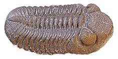
Phacops Rana
Tuesday, December 14, 2010

The first Americans
By George E. Beetham Jr.
Adventures on Earth column for December 8, 2010, edition of The Review
A cliff in eastern France looms over a rural valley. Sand dunes in southern Virginia lie within a loop of the Nottaway River.
Though geologically different, the two sites may be linked together to tell the story of the first inhabitants of North America.
The Rock of Solutre is a limestone mesa whose flanks are covered with vineyards. The rock dominates the region where artifacts of people who lived between 22,000 and 17,000 years ago were found.
These people subsisted on reindeer in a time when the last glaciation extended southward into France.
They left artifacts in caves in the region – stone and bone tools that had a distinctive kind of flaking. Also in the caves were drawings of animals of their world.
Named the Solutreans for the site where these artifacts were first found, these people lived in a wide area of southern France and Spain.
Cactus Hill is a tree-covered, 75-foot dune inside a loop of the Nottaway River. It is the location of an archeological site where two cultures have been found.
The most shallow was the Clovis culture. A deeper level contains artifacts from people who lived earlier than the Clovis – some15,000 to 18,000 years ago.
Both the Clovis culture and the earlier culture left stone tools that have the same flaking method as the Solutrean people of France. Bone tools like needles used to sew hides into garments and other implements also mirror Solutrean culture.
This discovery has completely unsettled what had been a prevailing theory about the origins of humans in North America.
The first Clovis site was found near and named for Clovis, New Mexico. Clovis artifacts have since been found in other sites, including Meadowcroft Rockshelter in southwestern Pennsylvania.
The old paradigm had the Clovis People moving into North America via the Bering land bridge that existed during the last glaciation, which ended some 11,000 years ago.
Since that theory first surfaced, archeologists have searched Alaska and Canada for artifacts of the Clovis People. They found none along the route that people moving from Asia traveled as they made their way into North America.
What is more, a skull of a person believed to have been Caucasian was found in a Clovis site in Washington state. Dubbed Kennewick Man, the skull was narrow rather than the broad skull of Asian migrants.
While Asians did migrate across the Bering land bridge, Clovis People may have come from France or Spain and entered North America long before Asians.
The Solutrean theory holds that Solutreans traveled across the Atlantic in small boats, possibly following the ice margin where seals and walruses would have provided food.
Theorists of this scenario point to similarities in the tools, evidence that is hard to dispute. There are others who argue otherwise, pointing to two distinct issues.
First, they say, the Solutreans show no evidence of sea faring skills. Additionally, the voyage across the Atlantic would have been too hazardous for any boats they might have built.
Skilled shipbuilding technology, however, need not have been required. In 1947, Norwegian explorer and writer Thor Heyerdahl proved that a primitive reed craft was capable of crossing the wider Pacific Ocean when he set out to prove that South Americans could have traveled to Polynesia. He set out from South America and successfully crossed the Pacific, finally landing on an island in his target destination.
Additionally, both Norse and English people are known to have crossed the Atlantic in craft that were not technologically sophisticated.
A link between the Solutreans and Clovis People will likely be argued for years. The similarities between the two cultures would seem to be based on more than happenstance. Solutreans, possibly from what is now Spain, could be the people who discovered America.
The Clovis people disappeared from the archeological record some 10,500 years ago. This was about the time when the last ice age ended. Climate change is believed to have affected many of the large mammal species on which the Clovis people depended.
Adventures on Earth column for December 8, 2010, edition of The Review
A cliff in eastern France looms over a rural valley. Sand dunes in southern Virginia lie within a loop of the Nottaway River.
Though geologically different, the two sites may be linked together to tell the story of the first inhabitants of North America.
The Rock of Solutre is a limestone mesa whose flanks are covered with vineyards. The rock dominates the region where artifacts of people who lived between 22,000 and 17,000 years ago were found.
These people subsisted on reindeer in a time when the last glaciation extended southward into France.
They left artifacts in caves in the region – stone and bone tools that had a distinctive kind of flaking. Also in the caves were drawings of animals of their world.
Named the Solutreans for the site where these artifacts were first found, these people lived in a wide area of southern France and Spain.
Cactus Hill is a tree-covered, 75-foot dune inside a loop of the Nottaway River. It is the location of an archeological site where two cultures have been found.
The most shallow was the Clovis culture. A deeper level contains artifacts from people who lived earlier than the Clovis – some15,000 to 18,000 years ago.
Both the Clovis culture and the earlier culture left stone tools that have the same flaking method as the Solutrean people of France. Bone tools like needles used to sew hides into garments and other implements also mirror Solutrean culture.
This discovery has completely unsettled what had been a prevailing theory about the origins of humans in North America.
The first Clovis site was found near and named for Clovis, New Mexico. Clovis artifacts have since been found in other sites, including Meadowcroft Rockshelter in southwestern Pennsylvania.
The old paradigm had the Clovis People moving into North America via the Bering land bridge that existed during the last glaciation, which ended some 11,000 years ago.
Since that theory first surfaced, archeologists have searched Alaska and Canada for artifacts of the Clovis People. They found none along the route that people moving from Asia traveled as they made their way into North America.
What is more, a skull of a person believed to have been Caucasian was found in a Clovis site in Washington state. Dubbed Kennewick Man, the skull was narrow rather than the broad skull of Asian migrants.
While Asians did migrate across the Bering land bridge, Clovis People may have come from France or Spain and entered North America long before Asians.
The Solutrean theory holds that Solutreans traveled across the Atlantic in small boats, possibly following the ice margin where seals and walruses would have provided food.
Theorists of this scenario point to similarities in the tools, evidence that is hard to dispute. There are others who argue otherwise, pointing to two distinct issues.
First, they say, the Solutreans show no evidence of sea faring skills. Additionally, the voyage across the Atlantic would have been too hazardous for any boats they might have built.
Skilled shipbuilding technology, however, need not have been required. In 1947, Norwegian explorer and writer Thor Heyerdahl proved that a primitive reed craft was capable of crossing the wider Pacific Ocean when he set out to prove that South Americans could have traveled to Polynesia. He set out from South America and successfully crossed the Pacific, finally landing on an island in his target destination.
Additionally, both Norse and English people are known to have crossed the Atlantic in craft that were not technologically sophisticated.
A link between the Solutreans and Clovis People will likely be argued for years. The similarities between the two cultures would seem to be based on more than happenstance. Solutreans, possibly from what is now Spain, could be the people who discovered America.
The Clovis people disappeared from the archeological record some 10,500 years ago. This was about the time when the last ice age ended. Climate change is believed to have affected many of the large mammal species on which the Clovis people depended.
Wednesday, December 1, 2010
The life of winter
Adventures on Earth column for the Dec. 1 edition of The Review
By George E. Beetham Jr.
Many people stop hiking during the cold winter months. Yet winter is a great time to get outdoors and check out what’s going on in the natural world.
Some people look at the natural world in winter and see a dead world. Nothing could be further from the truth. The forest is very much alive, a fact that will become readily apparent if there is snow on the ground.
That is when the creatures that are out and about leave tracks in the snow.
That is when a person can see that there really are turkeys in our woods – a fact that the otherwise elusive creatures tend to obscure the rest of the year.
In fact, if you are so inclined, you can follow turkey tracks through the forest and get an idea of what life is like for turkeys.
Deer also lurk in the winter forest, their long gray fur helping them to blend in to the black and gray forest.
Winter is not an easy time for deer. Most of the greens they eat during the growing season are gone in winter. Deer must settle for whatever they can dig up from the snow or the tips of woody shrubs and trees.
Bear may or may not be dozing the time away in their dens. Black bear, the kind that inhabit the East, are light sleepers that emerge on warmish days to prowl about in search of food.
Bear will dine on mast during winter – the acorns and other nuts that fall from trees and lie about on the forest floor.
Bobcat and coyotes roam the winter forest looking for deer or other creatures that can make a meal. Their chances of success in winter are increased if deer cannot get as much food as they need to stay healthy. It’s nature’s way of weeding out the weak and lame.
Squirrels and over-wintering birds flit through the forest, chipping or chirping alarms as two-legged intruders lope along a trail.
Some hawks and owls winter in the region, squirrels, rabbits, and birds on their winter menu.
Unless it gets unseasonably warm the insect world is gone from the winter forest. Many insects lay eggs and die before the cold sets in. Their eggs will hatch on warm days, filling streams with larvae and providing an early spring meal to fish and other aquatic creatures.
The leaves are gone from deciduous trees and from tamarack. Pines, spruce, hemlock, and balsam break up the gray-brown of the winter forest, accent points of green.
When high and low pressure align close together, the pressure differential between the two can force cold winds to descend from the north.
On days when that happens, trees groan and creak as they flex. At times a tree is bent too far and cracks with a loud report that sounds like a gunshot. It hits the ground with a thud. It’s an alarming sound, especially so since there are trees all around that are bent from the force of the wind.
Ice flows from cliffs like frozen waterfalls. When sunlight glints off the ice it seems almost alive as it sparkles.
Waterfalls freeze as well, with water sometimes still running amid the columns of ice. If the ice has built up over time it can be quite impressive.
On days when the temperature warms up a bit, another bit of geology can take place. Freezing water acts like a wedge in the cracks and joints of rock formations. When it warms up rock breaks loose and falls from cliffs.
Frost heaves push up from loose earth, another feature of the freeze-thaw cycle.
If you are lucky enough to be in the forest after fog freezes on trees and shrubs, you will delight in rime ice, appearing like frosting on a cake.
All of that and more can be found in the winter woods for those who get out and enjoy the life of winter.
Remember to wear sturdy, waterproof foot gear and to dress in layers. When hiking it’s good to avoid over-heating by removing a layer or two. When stopping to take a break, adding layers will keep you warm.
Enjoy the life of winter.
By George E. Beetham Jr.
Many people stop hiking during the cold winter months. Yet winter is a great time to get outdoors and check out what’s going on in the natural world.
Some people look at the natural world in winter and see a dead world. Nothing could be further from the truth. The forest is very much alive, a fact that will become readily apparent if there is snow on the ground.
That is when the creatures that are out and about leave tracks in the snow.
That is when a person can see that there really are turkeys in our woods – a fact that the otherwise elusive creatures tend to obscure the rest of the year.
In fact, if you are so inclined, you can follow turkey tracks through the forest and get an idea of what life is like for turkeys.
Deer also lurk in the winter forest, their long gray fur helping them to blend in to the black and gray forest.
Winter is not an easy time for deer. Most of the greens they eat during the growing season are gone in winter. Deer must settle for whatever they can dig up from the snow or the tips of woody shrubs and trees.
Bear may or may not be dozing the time away in their dens. Black bear, the kind that inhabit the East, are light sleepers that emerge on warmish days to prowl about in search of food.
Bear will dine on mast during winter – the acorns and other nuts that fall from trees and lie about on the forest floor.
Bobcat and coyotes roam the winter forest looking for deer or other creatures that can make a meal. Their chances of success in winter are increased if deer cannot get as much food as they need to stay healthy. It’s nature’s way of weeding out the weak and lame.
Squirrels and over-wintering birds flit through the forest, chipping or chirping alarms as two-legged intruders lope along a trail.
Some hawks and owls winter in the region, squirrels, rabbits, and birds on their winter menu.
Unless it gets unseasonably warm the insect world is gone from the winter forest. Many insects lay eggs and die before the cold sets in. Their eggs will hatch on warm days, filling streams with larvae and providing an early spring meal to fish and other aquatic creatures.
The leaves are gone from deciduous trees and from tamarack. Pines, spruce, hemlock, and balsam break up the gray-brown of the winter forest, accent points of green.
When high and low pressure align close together, the pressure differential between the two can force cold winds to descend from the north.
On days when that happens, trees groan and creak as they flex. At times a tree is bent too far and cracks with a loud report that sounds like a gunshot. It hits the ground with a thud. It’s an alarming sound, especially so since there are trees all around that are bent from the force of the wind.
Ice flows from cliffs like frozen waterfalls. When sunlight glints off the ice it seems almost alive as it sparkles.
Waterfalls freeze as well, with water sometimes still running amid the columns of ice. If the ice has built up over time it can be quite impressive.
On days when the temperature warms up a bit, another bit of geology can take place. Freezing water acts like a wedge in the cracks and joints of rock formations. When it warms up rock breaks loose and falls from cliffs.
Frost heaves push up from loose earth, another feature of the freeze-thaw cycle.
If you are lucky enough to be in the forest after fog freezes on trees and shrubs, you will delight in rime ice, appearing like frosting on a cake.
All of that and more can be found in the winter woods for those who get out and enjoy the life of winter.
Remember to wear sturdy, waterproof foot gear and to dress in layers. When hiking it’s good to avoid over-heating by removing a layer or two. When stopping to take a break, adding layers will keep you warm.
Enjoy the life of winter.
Tuesday, November 23, 2010
A weakening magnetic field
Adventures on Earth column for the November 24 edition of The Review
By George E. Beetham Jr.
A program on one of the cable science channels delved into Earth’s interior. In a two-hour program, they gave detailed explanations of what each of the four layers below ground is and how it affects the world in which we live.
Of course, we know best about the surface of the planet. We’ve lived in its embrace for thousands of years, so we have a lot of experience dealing with it and its foibles.
We know about earthquakes, volcanoes, hurricanes, tornadoes, rogue waves, and all the other ways the planet has to either take our lives or make life miserable for a long time.
We even know how the mantle – the region of hot, viscous rock – moves continents around the globe through heat convection.
It is the outer and inner cores that continue to mystify us.
The outer core is thought to be made up of liquid iron, or maybe many molten metals. Convection currents in the outer core may be responsible for variations in mantle temperature.
But it is the spinning of Planet Earth on its axis that agitates the outer core, spinning hotter matter around and keeping the pot stirred.
The inner core is solid iron. We know this because seismic recording devices bounce off the inner core when earthquakes occur. Around the world these readings show the inner core and its relative size.
While the inner core is hot, it is cooler than the outer core. It is now thought that the inner core is slowly expanding as the planet cools. In time, the entire planet will cool to a point where it will consist of solid material from surface to center.
That date is many millions, likely billions of years ahead of us. In the meantime a more pressing matter needs attention.
The Earth is protected from solar radiation by its magnetic field. As solar flares shoot radiation far from the sun as solar wind, the solar wind is deflected around Earth by the magnetic field.
The magnetic field is generated by the inner core, which sends out electrical pulses that create the field. Once thought to act like a dynamo, the electrical charge is what generates the field.
At both poles, the interaction between solar wind and magnetic field can be seen as aurora – the shimmering northern and southern lights.
When a large mass of solar radiation is released and shot outward, the aurora can be seen many miles away from the poles, even over eastern North America.
Over time, for reasons we don’t yet understand, the polarity of Earth’s magnetic field flips. What is now the north pole becomes the south pole and vice versa.
We know about polarity flips because the magnetic orientation is recorded in molten magma that cools and becomes solid. As the rock solidifies, the magnetic orientation is locked up as iron molecules orient themselves along the magnetic plane.
Earth is very likely in the early stages of just such a flip right now. First, the magnetic field is slowly weakening. East of Brazil in the Atlantic Ocean, the magnetic field has disappeared altogether.
Moreover, by studying the time between polarity flips, it appears we are about due for one to occur.
No human has lived through a polarity flip. The last one took place an estimated 700,000 years ago. So we don’t know exactly what will happen as the process plays itself out.
We do know that solar radiation would likely increase as the magnetic field weakens and stops. But we don’t know what that means for life, particularly human life.
But the Earth has gone through polarity shifts many times, and life has continued right on through the shifts.
We don’t know when the shift will happen and we don’t know how long it will take for the process to play out. There are these events that science cannot yet describe.
By George E. Beetham Jr.
A program on one of the cable science channels delved into Earth’s interior. In a two-hour program, they gave detailed explanations of what each of the four layers below ground is and how it affects the world in which we live.
Of course, we know best about the surface of the planet. We’ve lived in its embrace for thousands of years, so we have a lot of experience dealing with it and its foibles.
We know about earthquakes, volcanoes, hurricanes, tornadoes, rogue waves, and all the other ways the planet has to either take our lives or make life miserable for a long time.
We even know how the mantle – the region of hot, viscous rock – moves continents around the globe through heat convection.
It is the outer and inner cores that continue to mystify us.
The outer core is thought to be made up of liquid iron, or maybe many molten metals. Convection currents in the outer core may be responsible for variations in mantle temperature.
But it is the spinning of Planet Earth on its axis that agitates the outer core, spinning hotter matter around and keeping the pot stirred.
The inner core is solid iron. We know this because seismic recording devices bounce off the inner core when earthquakes occur. Around the world these readings show the inner core and its relative size.
While the inner core is hot, it is cooler than the outer core. It is now thought that the inner core is slowly expanding as the planet cools. In time, the entire planet will cool to a point where it will consist of solid material from surface to center.
That date is many millions, likely billions of years ahead of us. In the meantime a more pressing matter needs attention.
The Earth is protected from solar radiation by its magnetic field. As solar flares shoot radiation far from the sun as solar wind, the solar wind is deflected around Earth by the magnetic field.
The magnetic field is generated by the inner core, which sends out electrical pulses that create the field. Once thought to act like a dynamo, the electrical charge is what generates the field.
At both poles, the interaction between solar wind and magnetic field can be seen as aurora – the shimmering northern and southern lights.
When a large mass of solar radiation is released and shot outward, the aurora can be seen many miles away from the poles, even over eastern North America.
Over time, for reasons we don’t yet understand, the polarity of Earth’s magnetic field flips. What is now the north pole becomes the south pole and vice versa.
We know about polarity flips because the magnetic orientation is recorded in molten magma that cools and becomes solid. As the rock solidifies, the magnetic orientation is locked up as iron molecules orient themselves along the magnetic plane.
Earth is very likely in the early stages of just such a flip right now. First, the magnetic field is slowly weakening. East of Brazil in the Atlantic Ocean, the magnetic field has disappeared altogether.
Moreover, by studying the time between polarity flips, it appears we are about due for one to occur.
No human has lived through a polarity flip. The last one took place an estimated 700,000 years ago. So we don’t know exactly what will happen as the process plays itself out.
We do know that solar radiation would likely increase as the magnetic field weakens and stops. But we don’t know what that means for life, particularly human life.
But the Earth has gone through polarity shifts many times, and life has continued right on through the shifts.
We don’t know when the shift will happen and we don’t know how long it will take for the process to play out. There are these events that science cannot yet describe.
Monday, November 15, 2010
No rise in storms from global warming
By George E. Beetham Jr.
Adventures on Earth column for the Nov. 17 edition of The Review
Conventional wisdom held that global warming would mean higher sea surface temperatures and thus more and stronger hurricanes. It turns out conventional wisdom was wrong.
While the first part of the statement is true, warmer sea surface temperatures are virtually certain, the threshold for tropical cyclone formation would rise from the current 80 degrees Fahrenheit.
This means it would take warmer sea surface temperatures to trigger storm formation.
Hurricanes form as low pressure systems move over warm, tropical seas. At 80 degrees, the warm water evaporates and the warm, moist air rises, eventually forming clouds. The counter clockwise rotation of air around the low and the rising warm air funnel more and more moisture into the clouds.
As the speed of winds rotating around the low increase the storm draws more warm air inward. The rotation contracts, and eventually an eye develops.
Researchers at the University of Hawaii’s International Pacific Research Center (IPRC) have discovered that the threshold sea surface temperature for the convection of warm, moist air is rising at the same rate as the warming of the tropical seas.
The researchers studied records dating back 30 years and found that the threshold temperature closely followed the increase in average sea surface temperatures in the tropics. Both have been rising at the rate of one degree centigrade per decade.
Nat Johnson, lead author of the study and a postdoctoral fellow at the IPRC, said, “The correspondence between the two time series is rather remarkable. The convection threshold and average sea surface temperatures are so closely linked because of their relation with temperatures in the atmosphere extending several miles above the surface.”
Johnson and co-author Shang-Ping Xie, professor of meteorology at IPRC and University of Hawaii Manoa, found that temperatures in the upper atmosphere have been rising at the same rate as sea surface temperatures and the convection threshold.
The study means that global warming will not bring more frequent hurricanes as conventional wisdom had supposed.
The study also means there is no linkage between the increase in storm frequency in recent decades and global warming. Instead, tropical cyclone formation tends to run in a cycle of approximately 70 years.
The current cycle began with a peak about 1950 and the next peak would occur in 2020, assuming the 70-year cycle to be accurate.
One of the difficulties in tropical cyclone prediction is that accurate records only go back to the middle of the last century. Models of cyclone formation are thus based on relatively little data.
Still, the cyclical nature of cyclone formation appears to hold true in the Atlantic.
What meteorologists still have not determined is what effect, if any, global warming will have on storm intensity.
As scientists continue to focus on global warming and the effects it will have on weather, that question too will likely be answered sooner rather than later.
For the record, the Atlantic hurricane season is winding down, with just two weeks left before it ends. While it was a busy season, it fell far short of 2005, the record year.
This year there were 19 named storms of which seven were hurricanes with four of those reaching Category 4.
In 2005 there were 28 named storms (one of which was sub tropical) and 15 hurricanes, of which eight were major storms.
Adventures on Earth column for the Nov. 17 edition of The Review
Conventional wisdom held that global warming would mean higher sea surface temperatures and thus more and stronger hurricanes. It turns out conventional wisdom was wrong.
While the first part of the statement is true, warmer sea surface temperatures are virtually certain, the threshold for tropical cyclone formation would rise from the current 80 degrees Fahrenheit.
This means it would take warmer sea surface temperatures to trigger storm formation.
Hurricanes form as low pressure systems move over warm, tropical seas. At 80 degrees, the warm water evaporates and the warm, moist air rises, eventually forming clouds. The counter clockwise rotation of air around the low and the rising warm air funnel more and more moisture into the clouds.
As the speed of winds rotating around the low increase the storm draws more warm air inward. The rotation contracts, and eventually an eye develops.
Researchers at the University of Hawaii’s International Pacific Research Center (IPRC) have discovered that the threshold sea surface temperature for the convection of warm, moist air is rising at the same rate as the warming of the tropical seas.
The researchers studied records dating back 30 years and found that the threshold temperature closely followed the increase in average sea surface temperatures in the tropics. Both have been rising at the rate of one degree centigrade per decade.
Nat Johnson, lead author of the study and a postdoctoral fellow at the IPRC, said, “The correspondence between the two time series is rather remarkable. The convection threshold and average sea surface temperatures are so closely linked because of their relation with temperatures in the atmosphere extending several miles above the surface.”
Johnson and co-author Shang-Ping Xie, professor of meteorology at IPRC and University of Hawaii Manoa, found that temperatures in the upper atmosphere have been rising at the same rate as sea surface temperatures and the convection threshold.
The study means that global warming will not bring more frequent hurricanes as conventional wisdom had supposed.
The study also means there is no linkage between the increase in storm frequency in recent decades and global warming. Instead, tropical cyclone formation tends to run in a cycle of approximately 70 years.
The current cycle began with a peak about 1950 and the next peak would occur in 2020, assuming the 70-year cycle to be accurate.
One of the difficulties in tropical cyclone prediction is that accurate records only go back to the middle of the last century. Models of cyclone formation are thus based on relatively little data.
Still, the cyclical nature of cyclone formation appears to hold true in the Atlantic.
What meteorologists still have not determined is what effect, if any, global warming will have on storm intensity.
As scientists continue to focus on global warming and the effects it will have on weather, that question too will likely be answered sooner rather than later.
For the record, the Atlantic hurricane season is winding down, with just two weeks left before it ends. While it was a busy season, it fell far short of 2005, the record year.
This year there were 19 named storms of which seven were hurricanes with four of those reaching Category 4.
In 2005 there were 28 named storms (one of which was sub tropical) and 15 hurricanes, of which eight were major storms.
Farming in autumn
By George E. Beetham Jr.
Adventures on Earth column for the Nov. 10 edition of The Review
We are speeding our way through another calendar year. We are done with Daylight Saving Time. Thanksgiving is two weeks away, and winter is less than six weeks away. Autumn is half gone.
The leaves are mostly gone from the trees. What remains will be gone shortly. Hurricane season ends at the end of the month, and an active season it has been.
We’ve had a frost, at least in outlying areas if not the city proper.
In short, the natural world, for all intents, is into winter.
I can remember a November trip to my grandparents’ farm in Bucks County when I was a child. The farm was on a hill, and the wind howled over that hill. It was cold, colder than I had expected.
We were getting the hard corn ready for the mill. We called the hard corn horse corn. It was not the sweet corn that we eat, but corn raised specifically to be milled into feed for the herd of dairy cows.
We would feed the ears of hard corn into a mechanical sheller, driven by a belt off the tractor, that would strip the kernels of corn off the cob.
The kernels would tumble into a burlap sack and the cobs would be spit out the back into bushel baskets.
There were many uses for the cobs. My grandfather would use them as handles for files and knives that served several functions on the farm. They could also be broken up and spread as mulch on the fields.
For the kids, they were perfect for chucking at one another, and corn cob fights were not uncommon.
We worked at the job in spite of how cold it felt. I was not adequately clothed for that cold, and I remember being very uncomfortable and even more unhappy. Still, we worked until the job was finished and we retired to the farm house for hot chocolate with marshmallows and the warmth of a wood stove in the kitchen.
Ever since that day, the first really cold snap of autumn takes me right back to that day in the corn crib shelling the corn.
In the days when agriculture was a staple of our economy, a lot of people marked the passage of a year by what took place on a farm. Farm chores are cyclical, just like weather, and farmers spend the harvest season getting ready for winter.
During the growing season farmers plant, cultivate, weed, and nurture their crops. When they are ready for harvest, that becomes the next step in the progression of a farm year.
By late autumn, there are only a few jobs left, things set aside when more pressing business took precedence.
Over the winter it was necessary to feed, water, and milk the cows, shovel out the manure, and put down fresh straw. The cows chewed their cud and produced milk, along with the manure.
Cold weather, snow, ice, and howling winds made a farmer’s chores all the harder during the cold months, not unlike the challenges posed for city living.
If farming life was hard, it was also rewarding. As part of the harvest, food was put up, either canned in Mason jars or frozen. Thus the produce was available all year long in one form or another.
Those days are long gone, relegated to memory and dreams. But a brisk wind out of the northwest brings it all back in seconds – those days when late autumn made the chores a lot harder.
Adventures on Earth column for the Nov. 10 edition of The Review
We are speeding our way through another calendar year. We are done with Daylight Saving Time. Thanksgiving is two weeks away, and winter is less than six weeks away. Autumn is half gone.
The leaves are mostly gone from the trees. What remains will be gone shortly. Hurricane season ends at the end of the month, and an active season it has been.
We’ve had a frost, at least in outlying areas if not the city proper.
In short, the natural world, for all intents, is into winter.
I can remember a November trip to my grandparents’ farm in Bucks County when I was a child. The farm was on a hill, and the wind howled over that hill. It was cold, colder than I had expected.
We were getting the hard corn ready for the mill. We called the hard corn horse corn. It was not the sweet corn that we eat, but corn raised specifically to be milled into feed for the herd of dairy cows.
We would feed the ears of hard corn into a mechanical sheller, driven by a belt off the tractor, that would strip the kernels of corn off the cob.
The kernels would tumble into a burlap sack and the cobs would be spit out the back into bushel baskets.
There were many uses for the cobs. My grandfather would use them as handles for files and knives that served several functions on the farm. They could also be broken up and spread as mulch on the fields.
For the kids, they were perfect for chucking at one another, and corn cob fights were not uncommon.
We worked at the job in spite of how cold it felt. I was not adequately clothed for that cold, and I remember being very uncomfortable and even more unhappy. Still, we worked until the job was finished and we retired to the farm house for hot chocolate with marshmallows and the warmth of a wood stove in the kitchen.
Ever since that day, the first really cold snap of autumn takes me right back to that day in the corn crib shelling the corn.
In the days when agriculture was a staple of our economy, a lot of people marked the passage of a year by what took place on a farm. Farm chores are cyclical, just like weather, and farmers spend the harvest season getting ready for winter.
During the growing season farmers plant, cultivate, weed, and nurture their crops. When they are ready for harvest, that becomes the next step in the progression of a farm year.
By late autumn, there are only a few jobs left, things set aside when more pressing business took precedence.
Over the winter it was necessary to feed, water, and milk the cows, shovel out the manure, and put down fresh straw. The cows chewed their cud and produced milk, along with the manure.
Cold weather, snow, ice, and howling winds made a farmer’s chores all the harder during the cold months, not unlike the challenges posed for city living.
If farming life was hard, it was also rewarding. As part of the harvest, food was put up, either canned in Mason jars or frozen. Thus the produce was available all year long in one form or another.
Those days are long gone, relegated to memory and dreams. But a brisk wind out of the northwest brings it all back in seconds – those days when late autumn made the chores a lot harder.
Monday, November 1, 2010
Where fire and ice meet
Adventures on Earth column in The Review for Nov. 3, 2010.
By George E. Beetham Jr.
When Eyjafjalla in Iceland erupted last spring, it was assumed by volcanologists that a nearby volcano would follow. Katla still has not stirred to life as expected, but another volcano is rumbling.
Grimsvotn is a volcano that lies under an ice sheet (jokull in Icelandic), just as Eyjafjalla and Katla do. Grimsvotn is located northeast of Katla under an ice sheet that is far larger.
On Oct. 2 and 3, tremors were detected under Grimsvotn. That was followed by a small earthquake last Thursday, then flooding in the Gigjukvisl River.
The flood was caused by meltwater from the ice sheet, the melting caused by heat rising from a magma chamber under Grimsvotn.
Grimsvotn last erupted in 2004, then causing disruption of air traffic in Europe as the ash plume flowing from Grimsvotn drifted southeastward.
At that time there was no appreciable melting of ice, but a 1996 eruption did cause a meltwater flood.
These floods are known as glacial bursts (jokulhlaup in Icelandic). In 1996, the glacial burst occurred weeks after the eruption ended, flooding downstream to the sea. That glacial burst was predicted, allowing authorities to shut down the Icelandic ring road that circles the island.
Iceland is located athwart the Mid-Atlantic Ridge, a chain of volcanic fissures that spread outward, moving the ocean plates of the Atlantic away from the fissures.
The ridge surfaces on a peninsula southeast of the capitol city of Reykjavik, slicing northeastward, then eastward then northward to split the island. An arm of the fissures extends southward, and it is on this arm that Grimsvotn, Eyjafjalla, and Katla are located. Farther to the southwest is Surtsey, a volcanic island which emerged from the sea on Nov. 14, 1963.
Volcanologists relatively recently determined that water and volcanoes are an explosive mix. When water seeps into the volcano it is superheated, increasing pressure. When the pressure builds up sufficiently, there is a violent explosion with ejection of masses of volcanic ash, rock, and lava.
It was this kind of eruption that blew the top off Mount St. Helens in 1980 and Pinatubo in the Philippines in 1991. It was also the cause of the Eyjafjalla eruption last spring as well as previous eruptions of Katla.
In all three Icelandic cases, the volcanoes are topped with an ice field, the source of water once magma builds up and releases heat.
What happens next at Grimsvotn is anybody’s guess. Volcanologist think it will erupt violently, but a violent eruption of Katla was expected in the wake of Eyjafjalla and it has not happened.
The eruption of Eyjafjalla last spring spewed tons of ash into the atmosphere, shutting down air travel over Europe. When volcanic ash is ingested by jet engines, it can destroy the engine and cause the plane to crash.
That disruption of air travel cost money to airlines and to businesses dependent on air travel. An eruption of Grimsvotn could do the same thing, perhaps for a longer time.
Meanwhile, flooding from the volcano is an immediate threat to Iceland’s ring road and bridges. The ring road bridge over a sandbar was washed away in the 1996 flood.
Because of its location astride the Mid-Atlantic Ridge, Iceland and its volcanoes will continue to threaten air traffic disruption over Europe, as well as flooding on the island nation.
Iceland has been called a land of fire and ice. Where the two meet, things are bound to happen.
By George E. Beetham Jr.
When Eyjafjalla in Iceland erupted last spring, it was assumed by volcanologists that a nearby volcano would follow. Katla still has not stirred to life as expected, but another volcano is rumbling.
Grimsvotn is a volcano that lies under an ice sheet (jokull in Icelandic), just as Eyjafjalla and Katla do. Grimsvotn is located northeast of Katla under an ice sheet that is far larger.
On Oct. 2 and 3, tremors were detected under Grimsvotn. That was followed by a small earthquake last Thursday, then flooding in the Gigjukvisl River.
The flood was caused by meltwater from the ice sheet, the melting caused by heat rising from a magma chamber under Grimsvotn.
Grimsvotn last erupted in 2004, then causing disruption of air traffic in Europe as the ash plume flowing from Grimsvotn drifted southeastward.
At that time there was no appreciable melting of ice, but a 1996 eruption did cause a meltwater flood.
These floods are known as glacial bursts (jokulhlaup in Icelandic). In 1996, the glacial burst occurred weeks after the eruption ended, flooding downstream to the sea. That glacial burst was predicted, allowing authorities to shut down the Icelandic ring road that circles the island.
Iceland is located athwart the Mid-Atlantic Ridge, a chain of volcanic fissures that spread outward, moving the ocean plates of the Atlantic away from the fissures.
The ridge surfaces on a peninsula southeast of the capitol city of Reykjavik, slicing northeastward, then eastward then northward to split the island. An arm of the fissures extends southward, and it is on this arm that Grimsvotn, Eyjafjalla, and Katla are located. Farther to the southwest is Surtsey, a volcanic island which emerged from the sea on Nov. 14, 1963.
Volcanologists relatively recently determined that water and volcanoes are an explosive mix. When water seeps into the volcano it is superheated, increasing pressure. When the pressure builds up sufficiently, there is a violent explosion with ejection of masses of volcanic ash, rock, and lava.
It was this kind of eruption that blew the top off Mount St. Helens in 1980 and Pinatubo in the Philippines in 1991. It was also the cause of the Eyjafjalla eruption last spring as well as previous eruptions of Katla.
In all three Icelandic cases, the volcanoes are topped with an ice field, the source of water once magma builds up and releases heat.
What happens next at Grimsvotn is anybody’s guess. Volcanologist think it will erupt violently, but a violent eruption of Katla was expected in the wake of Eyjafjalla and it has not happened.
The eruption of Eyjafjalla last spring spewed tons of ash into the atmosphere, shutting down air travel over Europe. When volcanic ash is ingested by jet engines, it can destroy the engine and cause the plane to crash.
That disruption of air travel cost money to airlines and to businesses dependent on air travel. An eruption of Grimsvotn could do the same thing, perhaps for a longer time.
Meanwhile, flooding from the volcano is an immediate threat to Iceland’s ring road and bridges. The ring road bridge over a sandbar was washed away in the 1996 flood.
Because of its location astride the Mid-Atlantic Ridge, Iceland and its volcanoes will continue to threaten air traffic disruption over Europe, as well as flooding on the island nation.
Iceland has been called a land of fire and ice. Where the two meet, things are bound to happen.
Subscribe to:
Posts (Atom)