For Immediate Release
September 30, 2010
Flood Condition Plans
Thursday, September 30, 2010
In the event that a weather emergency is declared due to flood conditions throughout the city, Police Department personnel will be deployed to the following locations to implement street closures as the need arises:
Columbus Boulevard
Kelly Drive
Lincoln Drive
Martin Luther King Drive
Main Street in Manayunk
Roosevelt Boulevard
Cobbs Creek Parkway
Although the aforementioned locations are typical hotspots for flooding conditions and downed trees, there is the possibility that many other areas will be affected by flooding and high-winds as well. Thank you for your cooperation during this possible weather emergency.
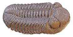
Phacops Rana
Thursday, September 30, 2010
Flood warning and tornado watch this afternoon and evening
Philadelphia is under a flood warning and a tornado watch until 7:45 this evening (Thursday) as remnants of tropical storm Nicole and a large low have merged and are moving northeastward up the coast. Heavy rains associated with this huge storm have caused flooding to our south.
Flood watch continued into Friday
What was Tropical Storm Nicole was absorbed into a low pressure trough along the Mid-Atlantic seaboard and was causing heavy rain in North Carolina on Thursday morning. The trough will continue to move through the region into Friday as moisture to the south moves northward. The flood watch for this area continues into Friday. Flood warnings were posted to the west this morning. A flood warning means that flooding is either imminent or occuring.
Wednesday, September 29, 2010
Area under flood watch until Thursday night
The National Weather Service has issued a flood watch for Philadelphia and the region. The flood watch extends until Thursday night.
According to the National Weather Service, low pressure associated with Tropical Storm Nicole will move up the East Coast tonight and Thursday. With extremely high moisture content... a strong storm inflow... and lots of instability... rain beginning tonight will be heavy at times later tonight and especially Thursday. The rain should taper off Thursday night as the center of tropical low pressure moves north of our area.
Total precipitation is expected to average 2 to 4 inches... but local amounts may be up to 6 or 7 inches. Although the forecast could change... at this time the greatest precipitation is expected over the northeast Maryland shore... eastern Pennsylvania... Delaware... and western New Jersey. Slightly lesser although still heavy amounts may occur closer to the New Jersey coast.
Tuesday, September 28, 2010
Tornado watch this afternoon
The region is under a tornado watch until 6 p.m. Tuesday. The National Weather Service reminds that a tornado watch means that a tornado is possible. If signs that a tornado is forming NWS will issue a tornado warning. However, there may not be sufficient time if a tornado develops rapidly.
Storms associated with the passage of a cold front result from unstable air, conditions that are favorable for tornado development.
Storms associated with the passage of a cold front result from unstable air, conditions that are favorable for tornado development.
New tropical storm threatens Cuba, U.S. East Coast
Tropical Depression 16 is approaching Cuba on Tuesday afternoon. The National Hurricane Center expects the storm to strengthen into a tropical storm. It would weakend somewhat over Cuba, but will emerge and pass up the eastern coast of Florida, then head toward the South Carolina-North Carolina state line by Thursday morning, according to NHC predictions. strengthening in the Atlantic is likely.
Wednesday, September 22, 2010
Dynamics of the Planet
Adventures on Earth column for the September 22 edition of The Review
Some of the oldest rock on Earth can be found in what is called the Canadian Shield, a circular shaped belt of rock running from Greenland down to the northeastern US border, and then westward over the Canadian prairie, then up to the Arctic Ocean.
Most of the rock in the formation was laid down from 2.45 to 1.24 billion years ago.
It is the foundation upon which the rest of North America was built. Unlike parts of the United States, the Canadian Shield never was covered by sea.
In two places the Shield dips just a bit into the United States: the Upper Peninsula of Michigan and the Adirondack Mountains. It is the Adirondack Mountain section that we will examine here.
The Adirondack Mountains of New York State are unique among American mountain chains. American mountains are generally uplifted as the result of collision of continental land masses.
The folding and faulting of mountains results from lateral compression when two land masses are pushed together.
The rocks of the Canadian Shield were formed this way in what was known as the Grenville Orogeny. An orogeny is a pulse of mountain building that takes place when continents collide.
The Grenville Orogeny brought the Canadian Shield together with what are now parts of Europe into a supercontinent that geologists call Rodinia. Rodinia eventually broke up, but then the continents came together again during the Alleghenian Orogeny that formed the supercontinent called Pangea. Pangea, in turn, broke up to form the present array of continents and islands.
After the break-up of Rodinia, the Adirondacks eroded away into an elevated plain (called a penneplain) like the rest of the Canadian Shield. Unlike the rest of the Shield, the Adirondacks were submerged under a sea. Sediments covered the Shield rock.
During the Tertiary, which began 65 million years ago until 1.6 million years ago, the Adirondacks began to rise. Geologists think a hot spot developed in the mantle below the continental rock.
Hot spots are upwellings of the viscous mantle rock. Hawaii and Yellowstone are two places located over hot spots. As ocean or continental plate moves over a hot spot, volcanoes form. As the plate moves, the hot spot remains fixed.
A hot spot under the Adirondacks would seem to be fairly new by geologic standards. Hot spots usually form a chain of volcanoes or scars on the land. There is no such chain for the Adirondacks.
The mountains continue to rise at the rate of 2-3 millimeters a year, very rapid by geologic standards.
What does this mean for the future? The Adirondacks will continue to rise, although the rate will vary, for some time to come.
What could happen next, as the mountains rise, is that the rock will stretch. At some point it will break, forming the beginnings of a rift valley. Parts of North America will drift apart as the sea spreads into the rift valley.
None of us will be around to witness the process, but eventually land masses will again begin to move together. That process is the dynamics of the planet.
Wednesday, September 15, 2010
Moving islands
Adventures on Earth column for September 15 edition of The Review
Continuing with our discussion of barrier islands, recent research seems to explain why some barrier islands continue to grow as sea levels rise and other to sink into the sea.
Conventional wisdom would seem to dictate that all barrier islands are in danger of being submerged as sea levels rise. But that is not the case.
As sea levels have risen, some barrier islands continue to migrate toward the mainland and stay above the waves.
Others migrate so slowly that rising sea levels overtake the natural course of replenishment.
The difference seems to be the base on which a barrier island stands.
Islands with a sand base, like North Carolina’s Outer Banks, are able to migrate ahead of rising levels. That is because there is plenty of sand at hand to replenish what would otherwise be lost.
As storms scour the seaward side of the islands, sand it washed into the sound where it accumulates on the landward side. And in some cases, beaches eroded in storms are later replenished as sand is transported through currents known as longshore drift.
Sand and sea interact, the sea moving sand from one area and depositing it in another.
In the case of the Outer Banks, inlets form and close as the sea overwashes the island, or transports sand to fill in the inlet.
Sand continually drifts into inlets, which are dredged to maintain channels for maritime shipping.
The configuration of Outer Banks islands is not the same as it was in Blackbeard’s time. Blackbeard was a master of navigation between shoals. He would be at a loss today because channels he used have filled in and new channels have replaced shoals.
Islands have changed their shape as the sea rearranges sand to suit its fleeing whims.
All of that rearranging of sand gives the barrier islands of the Banks a strong foundation, allowing sand to build up.
Barrier islands along the Gulf of Mexico coast are not based on sand, but mud that is deposited from rivers flowing into the Gulf. It is mud that forms the Mississippi Delta and the bayous along the coast.
The mud is not a stable base, so as sea level rises islands tend to sink.
Researchers have studied the Chandeleur Islands off Louisiana. Those islands are not able to reacquire sand as they migrate landward, so they are slowly sinking.
The researchers are turning their attention to other barrier islands. Those off the coast of Virginia and Maryland and other areas of the Gulf Coast will be studied to see if the patterns hold up there.
Barrier islands, remember, protect the coast from storms. As storms approach the barrier island is hit first. Robbed of heat and moisture from the sea, the storm loses its punch. The barrier island also absorbs storm surge that otherwise would be more damaging inland.
If barrier islands are lost, storms will vent their full fury on the coast.
The attempts of humans to protect barrier islands through breakwaters or sea walls interfere with the transport of sand and ultimately work against the intentions of the builders.
As currents transport sand, it eventually ends up where it will help rebuild the island as it moves.
Monday, September 13, 2010
Here come two more
Hurricane Igor is roaring its way across the tropical Atlantic, a Category 4 storm that will likely intensify to Category 5. Igor formed just off the coast of Africa on Sept. 7. For several days it meandered in the area of the Cape Verde Islands, over cooler waters. The storm showed good tropical storm formation, though, and after it moved into warmer waters to the west it intensified rapidly. As of Monday morning it was approaching the Leeward Islands, but the National Hurricane Center predicted it would turn to the northwest, and then more northward, heading toward Bermuda.
Next up was Tropical Storm Julia, which also formed off the coast of Africa in the vicinity of Cape Verde. It grew into a tropical storm on Monday and is tracking generally westward. It, too, is over cooler water but is likely to intensify as it moves into warmer water to the west. The National Hurricane Center predicts it will move more northwestward to the east of Igor.
Meanwhile, NOAA predicts the current La Nina pattern over the tropical Pacific will continue intensifying into winter. This will increase the likelihood of tropical cyclones in the Atlantic.
Saturday, September 4, 2010
And then, nothing
That quickly the storms in the Atlantic either dissipated or went north. As of 5 p.m. Saturday, Tropical Storm Earl was in the Gulf of St. Lawrence after battering Nova Scotia with tropical storm force winds. Earl made a glancing pass at the Outer Banks and Cape Cod, but otherwise passed out to sea on its route north.
Fiona and Gaston fizzled out, although the disturbed weather that was Gaston continues across the tropical Atlantic. Meteorologists are monitoring a disturbance in the Gulf of Mexico and another near the Cape Verde Islands. Other than that, the Atlantic is quiet. Clear, cooler air has descended over the eastern part of the country. Enjoy the respite. Hurricane season still has nearly three months of potential surprises.
Fiona and Gaston fizzled out, although the disturbed weather that was Gaston continues across the tropical Atlantic. Meteorologists are monitoring a disturbance in the Gulf of Mexico and another near the Cape Verde Islands. Other than that, the Atlantic is quiet. Clear, cooler air has descended over the eastern part of the country. Enjoy the respite. Hurricane season still has nearly three months of potential surprises.
Friday, September 3, 2010
Life in a marginal habitat
Adventures on Earth column for the September 8 edition of The Review
Again the Outer Banks in North Carolina experienced overwash from a hurricane. Several years ago Route 12, the main highway along the Banks, was severed at Mirlo Beach just north of Rodanthe.
Storm surge from Hurricane Earl apparently washed over the highway in several places and severed the route, isolating communities to the south.
The Outer Banks are barrier islands – a thin strip of sandy land lying offshore. The islands are cut during storms and then fill in as ocean waves move sand up and down the beaches.
The barrier islands generally protect the mainland from storms, taking the brunt of storm surges and often deflecting storms back out to sea.
They are marginal places where life clings to a tenuous existence. Many creatures use the islands to nest or propagate.
Storms and currents move sand, making maritime navigation tricky. Pilots must know the locations of shifting sand bars as they follow dredged channels on their routes from ports to the sea.
The pirate Edward Teach (or Thatch), known as Blackbeard, used his knowledge of channels and sand bars to elude British navy patrols, but finally met his end off the island of Ocracoke in a battle with a British patrol as they maneuvered between sand bars..
Barrier islands are not stable land masses. The Outer Banks is moving slowly west, a progression that has been taking place for centuries. To the west of the existing Banks, a thin ribbon of sand is accumulating in Pamlico Sound – the next stand of the barrier islands.
At times, tree stumps are uncovered by ocean waves. The trees were once on the western side of the island, but as the island moved west the tree stumps ended up on the east side.
All of this is to say that barrier islands and hurricanes are part of the natural progression. If no humans moved onto the islands, the process would go on at the whims of nature.
It is the human incursions that create issues. Humans build on the islands, then go about stabilizing the sandy strips in order to protect their investment.
When storms hit, beaches erode, homes fall into the sea, and islands are cut in two, isolating communities until workers can fill in the newly created inlets and restore the roads.
In the memory of living people, hundreds of yards of ocean front have been eroded away. Homes that were once far from the beach are now washed by waves at high tide.
Walking along isolated Outer Banks beaches, one finds not just shells and nautical debris, but bits and pieces of what were once homes wood panels, framing, plumbing fixtures, sometimes entire walls.
This is what happens when people build on barrier islands. The Jersey Coast is another place where the eternal battle between people and nature takes place.
Municipalities spend fortunes replenishing beach sand, piping it from offshore back to the beach. The process repeats after storms over and over again.
Earl’s glancing blow wreaked havoc not with barrier islands, but with what humans put on those barrier islands. Islanders know that when they build out there their building will ultimately meet its fate in some storm.
Had Earl made landfall or a more direct blow, the damages would have been much worse. As it is, Outer Bankers will roll up their sleeves, repair damages, fill in new inlets, rebuild roads, and life will go on.
It always does in marginal habitats.
Thursday, September 2, 2010
Hurricane Earl was downgraded from a Category 4 to a Category 3 storm as of 2 p.m., but still carrying a powerful punch. As it moves north the storm will be over slightly cooler water.
Earl is expected to make a glancing blow at the Outer Banks late tonight and another glancing blow at Cape Cod early Saturday. Later Saturday it is expected to plow into Nova Scotia as a Category 1 hurricane.
The projected path is well out to sea except for the Outer Banks and Cape Cod. Still, Earl will stir up heavy surf and perhaps a storm surge as it passes up the coast. Authorities warn against swimming or surfing.
There is also a slight chance the storm could deviate from its anticipated path and move inland. Keep a weather eye out for this storm in the next 36 hours.
Earl should pass out to sea; more storms coming
Hurricane Earl, strengthened again to a Category 4 storm with sustained winds of 145 miles per hour, was expected to graze the Outer Banks Thursday night and Friday morning before curving out to sea. Hurricane warnings were posted along the entire coast all the way to Cape Cod.
Even if Earl passes out to sea, heavy surf and storm surge remain threats along the coast. Authorities warn of dangerous undertow that can carry swimmers or surfers far out to sea.
The National Hurricane Center forecasts that Earl will pass off Cape May about 2 p.m. Friday.
Meanwhile, Tropical Storm Fiona appears to be curving northward and should track well out to sea. Another storm, Gaston, emerged as a tropical wave off the African Coast on Monday. It was upgraded yesterday to a tropical storm with winds at 40, but downgraded today to a tropical depression. Sea surface temperatures are favorable for storm development, so Gaston bears watching as it crosses the tropical Atlantic.
Yet another tropical wave emerged off the African Coast today. Stay tuned; we are in the peak of hurricane season in what promises to be a busy year.
Subscribe to:
Posts (Atom)