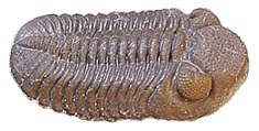
Phacops Rana
Wednesday, October 6, 2010
Storm intensifies, but expected to turn out to sea
The tropical wave that the National Hurricane Center was tracking near the Windward Islands intensified as expected into Tropical Depression 17. The National Hurricane Center is forecasting the storm to curve away from its northwesterly track to a northeasterly track - a track that would take it far out into the mid-Atlantic. The turn will take place in the next 24 hours. The storm is expected to intensify into Tropical Storm Otto by that time, but it is not expected be a threat to the East Coast.

Tuesday, October 5, 2010
New storm brewing
Forecasters are following another tropical wave that is now dumping rain on the Windward Islands, Puerto Rico, and the Dominican Republic. The wave currently has sustained winds at 30 miles per hour, but it is expected to intensify into a tropical depression sometime Wednesday afternoon and perhaps become Tropical Storm Otto by Thursday. Given the flooding of last week, keeping a weather eye out for this storm would be prudent, particularly if you live or work near the Schuylkill River.
Humble seeds
Adventures on Earth column for the October 6 edition of The Review
The Manayunk Canal was a short section of what was the interstate highway system of the late 18th and early 19th centuries. Up and down the eastern seaboard, canals followed waterways that carried the commerce of the new nation.
The Manayunk Canal is a skirting canal. That is, the canal skirted Black Rock Falls.
Skirting canals were the first canals in the United States, built on the fall line where river gave way to estuary.
Below the fall line, the estuary provided a fast, economical means of transporting goods and raw materials.
Above the fall line, bateaux, rafts, and Durham boats carried goods up the river and raw materials down the river. Above the fall line navigations was subject to rapids and other obstacles.
The idea of a through canal provided an easy navigational route – smoother transportation than hauling goods on wagons over rutted, rocky, muddy roads. There was less resistance in the water than on wagon roads. Larger and heavier loads became possible on canals.
The Schuylkill Navigation was not a through canal, but a series of skirting canals linking long stretches of slackwater navigation behind dams that also provided water for the skirting canals.
The Delaware Canal was a through canal linking Easton and Bristol. Travel on the Lehigh Canal extended navigation on those rivers into the anthracite fields of Eastern Pennsylvania.
Canals, out of necessity, followed rivers upstream. Rivers provide the easiest grades, meaning less locks were required to lift of lower boats as they moved up or down the canal.
In their day, canals were a very practical solution to transportation challenges. But they also had two serious drawbacks; they were subject to freezing in winter and flooding at any time of the year.
Navigation halted for winter and after floods. Goods could not be moved during times when the canal was out of operation. For that reason, railroads came into being. Like canals, railroads followed river routes, at least in the early days. But they could operate year round and were easily rebuilt following floods.
Canals, and later railroads, were engineering marvels in their time. The underlying geology was often an obstacle that engineers had to overcome, whether digging into rock or shoring up berms or towpaths. Locks were likely the most complicated engineering challenge.
The Union Canal between Reading and Middletown on the Susquehanna faced several serious engineering challenges.
First, the summit level of the canal – the highest elevation on the canal – was near Lebanon in the Great Valley. The Great Valley is underlain by limestone, which is soluble in acidic water. The engineers had to use lumber to line the canal and keep the water from leaking out.
The summit level was also higher than any water source, so the Union Canal builders had to construct a pumping station to take water from the Swatara Creek up to the summit level.
Then a ridge northwest of the town was an obstacle that was overcome by drilling a tunnel through the rock to carry the canal and towpath under the ridge.
All of that contrasts to the Schuylkill Navigation, where dams and skirting canals posed less of an engineering challenge where much of the navigation was provided by nature.
Railroads eventually replaced canals, which lingered on in some cases into the 20th Century.
The canals that have been preserved also face challenges due to periodic flooding. But they have value by reminding us that the transportation network we now have grew from humble seeds.
The Manayunk Canal was a short section of what was the interstate highway system of the late 18th and early 19th centuries. Up and down the eastern seaboard, canals followed waterways that carried the commerce of the new nation.
The Manayunk Canal is a skirting canal. That is, the canal skirted Black Rock Falls.
Skirting canals were the first canals in the United States, built on the fall line where river gave way to estuary.
Below the fall line, the estuary provided a fast, economical means of transporting goods and raw materials.
Above the fall line, bateaux, rafts, and Durham boats carried goods up the river and raw materials down the river. Above the fall line navigations was subject to rapids and other obstacles.
The idea of a through canal provided an easy navigational route – smoother transportation than hauling goods on wagons over rutted, rocky, muddy roads. There was less resistance in the water than on wagon roads. Larger and heavier loads became possible on canals.
The Schuylkill Navigation was not a through canal, but a series of skirting canals linking long stretches of slackwater navigation behind dams that also provided water for the skirting canals.
The Delaware Canal was a through canal linking Easton and Bristol. Travel on the Lehigh Canal extended navigation on those rivers into the anthracite fields of Eastern Pennsylvania.
Canals, out of necessity, followed rivers upstream. Rivers provide the easiest grades, meaning less locks were required to lift of lower boats as they moved up or down the canal.
In their day, canals were a very practical solution to transportation challenges. But they also had two serious drawbacks; they were subject to freezing in winter and flooding at any time of the year.
Navigation halted for winter and after floods. Goods could not be moved during times when the canal was out of operation. For that reason, railroads came into being. Like canals, railroads followed river routes, at least in the early days. But they could operate year round and were easily rebuilt following floods.
Canals, and later railroads, were engineering marvels in their time. The underlying geology was often an obstacle that engineers had to overcome, whether digging into rock or shoring up berms or towpaths. Locks were likely the most complicated engineering challenge.
The Union Canal between Reading and Middletown on the Susquehanna faced several serious engineering challenges.
First, the summit level of the canal – the highest elevation on the canal – was near Lebanon in the Great Valley. The Great Valley is underlain by limestone, which is soluble in acidic water. The engineers had to use lumber to line the canal and keep the water from leaking out.
The summit level was also higher than any water source, so the Union Canal builders had to construct a pumping station to take water from the Swatara Creek up to the summit level.
Then a ridge northwest of the town was an obstacle that was overcome by drilling a tunnel through the rock to carry the canal and towpath under the ridge.
All of that contrasts to the Schuylkill Navigation, where dams and skirting canals posed less of an engineering challenge where much of the navigation was provided by nature.
Railroads eventually replaced canals, which lingered on in some cases into the 20th Century.
The canals that have been preserved also face challenges due to periodic flooding. But they have value by reminding us that the transportation network we now have grew from humble seeds.
Thursday, September 30, 2010
Philadelphia Police Dept. Flood Plans
For Immediate Release
September 30, 2010
Flood Condition Plans
Thursday, September 30, 2010
In the event that a weather emergency is declared due to flood conditions throughout the city, Police Department personnel will be deployed to the following locations to implement street closures as the need arises:
Columbus Boulevard
Kelly Drive
Lincoln Drive
Martin Luther King Drive
Main Street in Manayunk
Roosevelt Boulevard
Cobbs Creek Parkway
Although the aforementioned locations are typical hotspots for flooding conditions and downed trees, there is the possibility that many other areas will be affected by flooding and high-winds as well. Thank you for your cooperation during this possible weather emergency.
September 30, 2010
Flood Condition Plans
Thursday, September 30, 2010
In the event that a weather emergency is declared due to flood conditions throughout the city, Police Department personnel will be deployed to the following locations to implement street closures as the need arises:
Columbus Boulevard
Kelly Drive
Lincoln Drive
Martin Luther King Drive
Main Street in Manayunk
Roosevelt Boulevard
Cobbs Creek Parkway
Although the aforementioned locations are typical hotspots for flooding conditions and downed trees, there is the possibility that many other areas will be affected by flooding and high-winds as well. Thank you for your cooperation during this possible weather emergency.
Flood warning and tornado watch this afternoon and evening
Philadelphia is under a flood warning and a tornado watch until 7:45 this evening (Thursday) as remnants of tropical storm Nicole and a large low have merged and are moving northeastward up the coast. Heavy rains associated with this huge storm have caused flooding to our south.
Flood watch continued into Friday
What was Tropical Storm Nicole was absorbed into a low pressure trough along the Mid-Atlantic seaboard and was causing heavy rain in North Carolina on Thursday morning. The trough will continue to move through the region into Friday as moisture to the south moves northward. The flood watch for this area continues into Friday. Flood warnings were posted to the west this morning. A flood warning means that flooding is either imminent or occuring.
Wednesday, September 29, 2010
Area under flood watch until Thursday night
The National Weather Service has issued a flood watch for Philadelphia and the region. The flood watch extends until Thursday night.
According to the National Weather Service, low pressure associated with Tropical Storm Nicole will move up the East Coast tonight and Thursday. With extremely high moisture content... a strong storm inflow... and lots of instability... rain beginning tonight will be heavy at times later tonight and especially Thursday. The rain should taper off Thursday night as the center of tropical low pressure moves north of our area.
Total precipitation is expected to average 2 to 4 inches... but local amounts may be up to 6 or 7 inches. Although the forecast could change... at this time the greatest precipitation is expected over the northeast Maryland shore... eastern Pennsylvania... Delaware... and western New Jersey. Slightly lesser although still heavy amounts may occur closer to the New Jersey coast.
According to the National Weather Service, low pressure associated with Tropical Storm Nicole will move up the East Coast tonight and Thursday. With extremely high moisture content... a strong storm inflow... and lots of instability... rain beginning tonight will be heavy at times later tonight and especially Thursday. The rain should taper off Thursday night as the center of tropical low pressure moves north of our area.
Total precipitation is expected to average 2 to 4 inches... but local amounts may be up to 6 or 7 inches. Although the forecast could change... at this time the greatest precipitation is expected over the northeast Maryland shore... eastern Pennsylvania... Delaware... and western New Jersey. Slightly lesser although still heavy amounts may occur closer to the New Jersey coast.
Subscribe to:
Posts (Atom)